

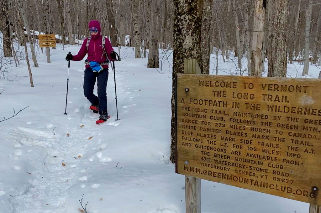
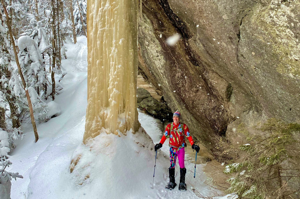
Sue Johnston and her husband, Chris Scott, park at the Route 9 trailhead in Bennington. No hikers greet them, nor do they expect any to at 3 a.m. on a March morning. Chris says his goodbyes as Sue slips into socks, boots, and Microspikes. She heads northbound up the Long Trail carrying enough gear for an emergency overnight, two liters of water, snacks, a GPS tracker on her phone, a charger, a map and compass, and snowshoes. After all, a 22.6-mile hike awaits her if she is to complete the last section of her winter end-to-end hike along the Long Trail. Chris will meet her at the finish line.
That day — March 8, 2021 — marks Sue’s 25th nonconsecutive day and third season working toward the goal of completing all 272 miles in winter. It’s also her fourth attempt; in December 2013, she set off from Journey’s End Road but retreated due to deep snow and an indiscernible trail. In 2014, she made two more attempts with the same results.
“I wasn’t accustomed to ‘failing’ that much,’” says Sue, already an accomplished hiker and mountaineer with nearly 30 years of winter hiking experience. “I could’ve bushwhacked, but I wanted to be on the LT proper as much as possible. It was a wake-up call to get my act together and get a GPS tracker.”
So, in summer 2017, Sue tracked the length of the Long Trail herself via her fifth LT thru-hike. And on her 53rd birthday — December 23, 2018 — she again started southbound from Journey’s End. “I finally made it from North Jay Pass to Jay Pass, convinced that maybe, just maybe, this was doable after all,” she wrote on her blog, RunSueRun.
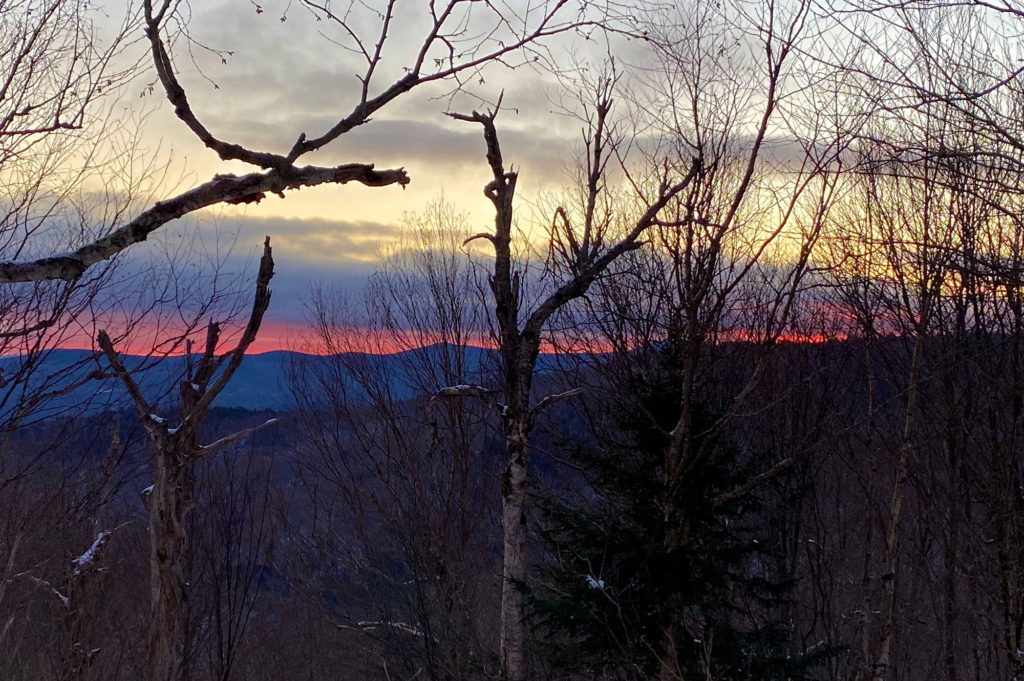
Now 55 and sensing the finish line, Sue climbs the dark, steep 1.6 miles to Melville Nauheim Shelter before switching into snowshoes. She eyes the handwarmers in her pack, which she carries to ease the pain of her Raynaud’s disease — a condition that causes your blood vessels to overreact and limit blood supply in your hands and feet when exposed to cold or stress. Deciding against it, she continues; she has 21 more miles to go before reaching Kelley Stand Road in Stratton.
“It was the most intimidating day for sure because of the mileage, and it’s not very well traveled in winter,” recalls Sue.
* * * * * * * *
Sue first considered a winter Long Trail hike after reading about it in Forest and Crag: A History of Hiking, Trail Blazing, and Adventure in the Northeast Mountains. The book profiles Tom and Diane Sawyer, a couple who completed the section hike in the 1980s. Although impressed that the feat happened with ‘80s-era gear, Sue decided to take up the challenge with more modern technology.
“The Whites’ popular peaks get super crowded, even in winter, which was my reason to do the Long Trail. I love the Long Trail, and in winter, you don’t have to deal with the mud, bugs, heat, and overcrowding,” she says.
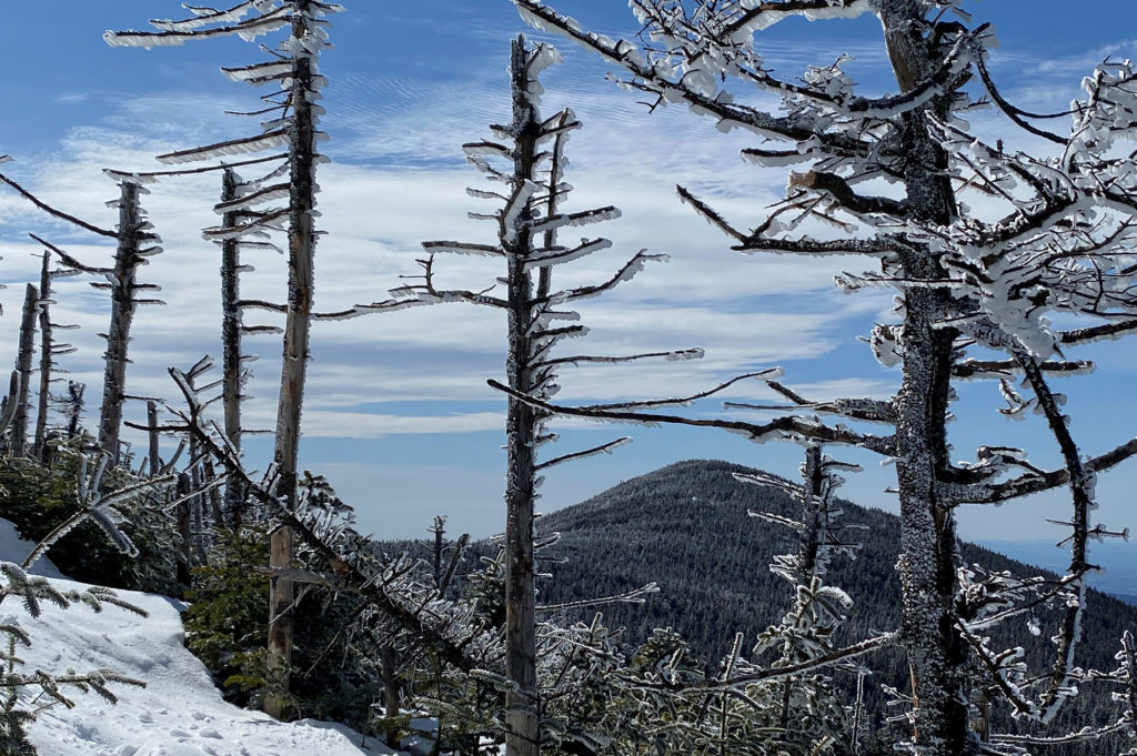
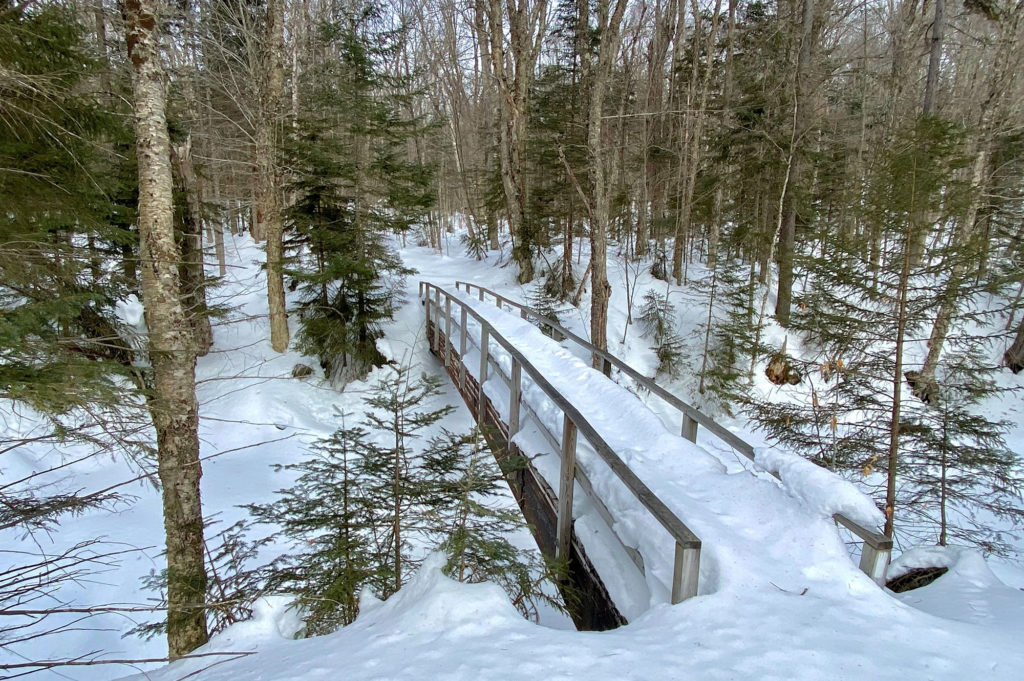
That doesn’t mean winter hiking comes without challenges; the biggest obstacle is finding the trail. With more than a foot of snow, there’s no discernible indentation where the trail should be, explains Sue. Snow camouflages the white blazes, and the cold and darkness are real dangers.
“Your margin of error is so thin,” says Sue. “It’s really hard to follow the trail in a normal snow year. In a lighter snow year, it would be easier. The snow adds this huge extra challenge.” Having tracked the footpath over the summer boosts Sue’s confidence, although she’s also handy with a map and compass.
“I don’t know how some people before me did it without GPS,” she wonders aloud. “I never 100 percent relied on my phone, but thankfully, it never let me down, so I never had to use my compass.” [The GPS tracker can work without regular cell service, which is unreliable on the LT. Cold weather can drain cell phone batteries more quickly as well.]
The snow presented some fun surprises too, Sue admits. To prep for the steep, scrambly sections and ladders, Sue packed crampons, a rope, and an ice ax. “I was really nervous about the section going south off Mansfield,” she says. Upon arriving though, she found many of the ladders completely buried.
“It made it much easier because I could just slide down. It wasn’t hard or scary at all. Going up [Mansfield’s] Chin is scarier than going down all those ladders,” she laughs.
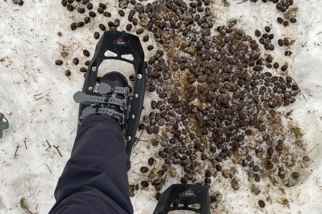
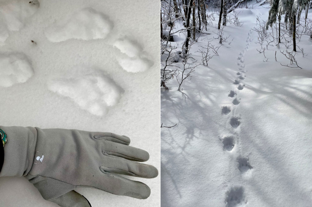
Another perk? Animal tracks are clearer in the snow. “Between Lincoln Gap and Middlebury Gap, I saw animal tracks for almost every mammal in Vermont,” says Sue. “The animals like the trail and walk along it.”
This benefited Sue, who says she followed a coyote for miles. When she became disoriented, she’d check the GPS and it matched with the canine’s prints. “I started trusting this coyote. He stuck to the trail!”
* * * * * * * *
Sue skis and is an avid summer hiker; winter hiking was a natural extension of that. She began winter hiking as a young adult in the early ‘90s, so she has plenty of experience to call upon.
“Back then, it was harder to find people who winter hike, but I got snowshoes and fell in with a group of people who did it,” she explains. Breaking trail in the snow cover is difficult, which is why most of the LT — apart from icons like Mt. Abe, Mansfield, and Camel’s Hump — remains relatively untouched through winter, even today, she says. “It’s difficult to do it solo.”
Considering that, her attitude toward planning this trek is relatively nonchalant, apart from thru-hiking for GPS purposes. “I already had everything. This was just day hiking,” she says.
And while Sue dislikes winter camping — which she credits to an expedition up Denali — she still prepared for emergency overnights. She carried a bivy and foam pad, along with her usual gear: a down jacket designed for mountaineering, insulated pants, a small stove and pot, “monster Black Diamond mittens,” and a thermos of Campbell’s tomato soup. She estimates her daypack weighed 20-25 pounds.
She kept up her energy levels with “whatever looked good that day,” with little consideration for calories. “In the winter, you have to worry about things freezing. You don’t bring a banana because it will turn black, and you don’t bring something that’ll break your teeth when you bite into it,” she says. She consumed CLIF Nut Butter Bars, Snickers, Cabot cheese, bagels, and occasionally, salami.
“I didn’t have to learn all this because I’ve been doing this for so long. It’s second nature to me,” Sue says. “I know how to read my body. I know how to manage moisture with layering. I know how to eat and drink. I know navigation,” she says.
* * * * * * * *
Past Maple Hill, Sue struggles to stay on the trail among the open hardwood forests, especially around Little Pond Mountain, Glastenbury Mountain, and Kid Gore Shelter. She compares it to a spruce forest where the trees grow denser, and the trail gap is more discernible. “But oh, what beautiful hardwoods,” she wrote in her blog.
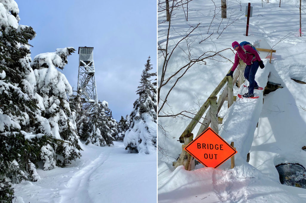
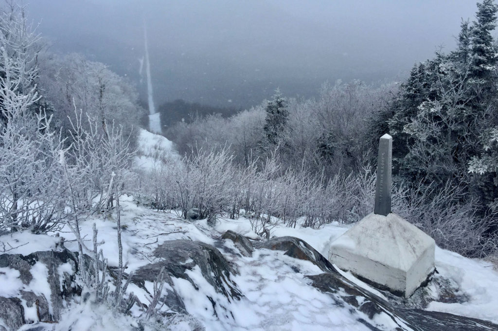
Sue checks her GPS often and sticks to the trail as adamantly as she can. At Glastenbury, she unfastens her snowshoes to climb the fire tower and take in the view. She spots snowmobile trails, which she’ll cross as she continues northbound.
She’d followed the trail southbound for most of her hike, but for logistical reasons, she had switched the last few hikes around. From Glastenbury Mountain, she has 12.2 miles to go. That’s nothing compared to the 150 miles she had left at the start of the season. Between 2018 and 2020, Sue had hiked 120 miles of the LT.
“The first winter, I was dabbling and wasn’t fully sure I could do it,” she says, adding that her mom was also battling Stage 4 cancer and passed away. “The second winter, I got to Lincoln Gap and thought, ‘I can do this. I got the hardest part done.’” By the third season, Sue was eager to finish.
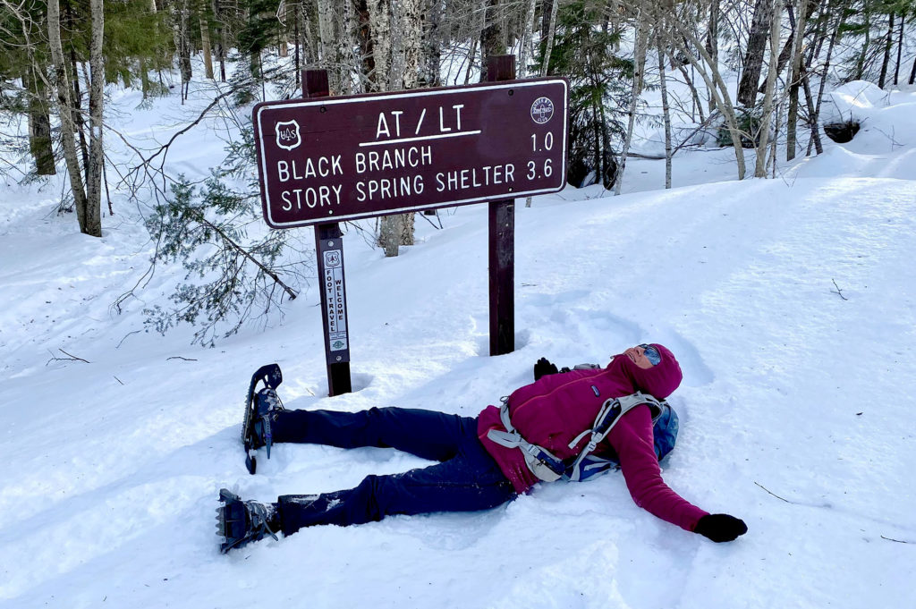
After passing Story Spring Shelter, Sue notices more foot traffic. She doesn’t mind hiking alongside others but says that being an introvert enhanced her trek.
“I don’t mind being alone. I get completely lost in my thoughts and I’m so interested in my surroundings,” she says. “I wasn’t going to let the lack of a partner keep me from doing this. In the end, it was very satisfying to do it alone.”
When Sue reaches Kelley Stand Road around 4:20 p.m., she becomes the 11th known winter end-to-ender. Chris waits for her at the trail head, and the two scramble into the car and head back to their Lyndon home. “Whenever I finish something like this, it’s bittersweet,” she says. “I’m happy I did it, but sad it’s over.”
* * * * * * * *
Overall, Sue hiked approximately 304 miles, which includes approach trails and unplowed roads; of the LT miles, 247 (more than 90 percent) were solo, she writes. It took 25 day hikes over three winters to complete.
Looking forward, Sue has many more adventures planned. “I’m a peak bagger, so I’m always working on these obscure lists,” she says.
This past summer, she finished Vermont’s 110, 3,000-footers. She and Chris are currently working on the Northeast Kingdom’s 100 highest peaks, which require a lot of bushwhacking, she explains. But she knows she can do it.
“I remember when I first started hiking; if I lost the trail, I immediately freaked out,” she says, reflecting on her growth. “I’m not like that anymore.”
* * * * * * * *
This post was written by Angela Hilsman, GMC communications coordinator. It appeared in the Winter 2021 edition of the Long Trail News under the headline “Hiking End-to-End in Winter.”


I love this Thank you so much for sharing your adventure. Super cool pictures too Congratulations
Awesome post. I just started winter hiking this year, and backpacking this summer (on the LT), so Sue’s adventures are putting ideas in my head. Thanks!
Great story and very inspiring to all us 55+ hikers out there! Thanks for sharing the story and the photos.