

The Green Mountain Club periodically updates this page with trail closures, conditions, and reports on the Long Trail, Appalachian Trail in Vermont, and Northeast Kingdom Trails. We encourage hikers to share their trail observations with the Club either by contacting our Visitor Center or filling out the form at the bottom of this page. Please be aware that all such trail updates sent to the Club may be used and publicized on this page with the source cited.
GMC also posts conditions reports frequently in our Facebook Group.
Trail Changes & Closures
Jump To:
Long Trail Relocations and Closures
Including: Peru Peak Bridge; Homer Stone Brook Bridge; Long Trail at Prospect Rock (Johnson); Temporary Long Trail Reroute on Duxbury Road (updated 7.1.26)
Parking and Trailhead Access Alerts
Including: Parking Enforcement on Camel’s Hump Road in Huntington
General Guidelines / Seasonal Closures
Including: Seasonal trail closures during peregrine falcon nesting season, Trail Magic Guidelines, Food Storage Regulations
Resolved Alerts
Long Trail Trail and Shelter Relocations and Closures
from south to north
Back to top ↑
Updates for the relocated Seth Warner Shelter, Stratton Pond Area Trails, and Sunrise Shelter are reflected in the new Long Trail Map, 7th edition.
Glastenbury Fire Tower Remains Closed.
Please do not climb or otherwise use the Glastenbury fire tower. Green Mountain National Forest is in the process of securing funding to repair the tower.
Peru Peak Bridge Closure on LT/AT at mile 64.5
The bridge just north of Peru Peak Shelter has been removed. Hikers should ford the stream using a rock hop near the former bridge site — it is marked with signage. GMC crews will replace the bridge this season.
Homer Stone Brook Bridge Closure on LT/AT mile 75.5
Hikers should be advised that as of 5/19/26, the bridge over Homer Stone Brook on the Long Trail/Appalachian Trail just north of Little Rock Pond will be removed/closed and hikers should ford the stream using a rock hop just to the right/east of the existing bridge site. GMC crews will be replacing the bridge, which was damaged in the 2023 floods, this season. The old bridge was removed on 5/19 to make room for a helicopter airlift that will be dropping the new bridge’s stringers into place on 6/24. From this point on, it is important that hikers continue to do the rock hop and do not attempt to use the new bridge materials, as construction is ongoing and the bridge is not secure. Signage will be posted on site.
In the event of high water hikers should seek alternate routes and/or review these water crossing safety techniques.
Lake Mansfield Trail Bridge Closed
Due to structural concerns, the bridge on the Lake Mansfield Trail is closed as of 8/23/24. The trail remains open, and hikers will have to ford the stream until the bridge is replaced. In times of high water it may be a hazardous crossing. At this time, there is no timeline on the bridge’s replacement.
Long Trail Reroute: Northern Farm Fields in Winooski Valley
In addition, a temporary reroute is in place for LT through farm fields between the Winooski Footbridge and Honey Hollow Road/Preston Brook, to avoid electric fencing issues. Please use Duxbury Road (open to pedestrians and one lane of vehicle traffic) from the Winooski Footbridge to roughly Honey Hollow Road/Preston Brook crossing. (0.7 mi total).
Northbound hikers: Just before Preston Brook, turn left to take the blue-blazed highwater route from the LT to the road, then continue north/west on the road to the footbridge.
Southbound hikers: After crossing the footbridge, walk on the road roughly 0.7 mi, past Honey Hollow Road, and cut back to the LT via the blue-blazed highwater route on your left.
Signage will be posted on site.
The Long Trail at Prospect Rock, Johnson, has been relocated to avoid the cliff area. The new permanent route of the LT uses the relocation that is in effect annually when the cliff is closed for nesting peregrine falcons. Prospect Rock, when open, can now be reached via a short spur trail to the north. Please follow all posted signage, including closures for nesting season. This reroute changes the distance of the trail segment from Route 15 to Prospect Rock Road, from 1.7 miles to 1.5 miles.* Please note, the spur trail is closed during peregrine falcon nesting season (typically April through August).
Parking and Trail Access Closures
Parking Enforcement on Camel’s Hump Road in Huntington
Parking on the side of the road is not permitted on Camel’s Hump Road in Huntington. Please consider carpooling or visiting on off-peak days. If parking lots are full please turn around and find an alternative nearby hike. Beginning summer 2025, the town of Huntington plans to install new no-parking signs along Camel’s Hump Road and enforcing a parking ordinance. Vehicles that park on the side of the road may be subject to a ticket and/or towing. This ordinance is for safety, so that emergency vehicles can access the trailhead and residences on the road.
Winooski River Footbridge, Parking Closure
Parking is not allowed on the south side of the footbridge. The only current parking for the bridge is on Route 2. Map it.
General Guidelines / Seasonal Closures
Season Trail Closures to Protect Nesting Peregrine Falcons
Several trails and cliff areas are closed to protect the sites of nesting peregrine falcons. Nesting periods typically last from March/April through August, during which breeding falcons are especially sensitive to human activity. Vermont Fish and Wildlife keeps a full list of the closed sites each year, and throughout April additional sites may be added or removed as biologists confirm nesting sites.
Bolton Notch (Bolton) – UUW cliff – cliff access and climbing closed
Bone Mountain (Bolton) – portions closed to climbing
Deer Leap (Bristol) – cliff-top and climbing closed
Eagle Ledge (Vershire) – closed to hiking and climbing
Dummerston Quarry (Dummerston) – upper quarry closed
Hazen’s Notch (Lowell) – portions closed to climbing
Fairlee Palisades (Fairlee) – cliff-top closed
Marshfield Mt (Marshfield) — portions closed to climbing
Mt Horrid (Rochester) – Great Cliff overlook closed
Nichols Ledge (Woodbury) – cliff-top and climbing closed
Prospect Rock (Johnson) – cliff-top overlook and climbing closed, spur trail closed
Red Rocks Park (S. Burlington) – southern cliff access closed
Rattlesnake Point (Salisbury) – southern overlook closed
Snake Mountain (Addison) – entire western trail closed
Notice on “Trail Magic” Activities in the Green Mountain National Forest
Hikers and “trail angels” (volunteers) please be advised that the Green Mountain National Forest has issued new guidance on “trail magic” for hikers and backpackers. This guidance comes in response to an increase in unattended food and beverages, leading to concerns around bear activity and waste disposal.
All “trail magic” — including water, cold drinks, snacks, prepared foods — may only be given out with a volunteer physically present. Any trail magic left unattended will be removed and disposed. This guidance applies to cached food and resupplies as well. Thank you for your helping us keep the Long Trail System litter free and a safe place for humans and wildlife to co-habitat.
Black Bear Activity
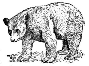
Forest Service officials announced July 24, 2019, that they are implementing a Forest Order for the entire Green Mountain National Forest (GMNF) geared toward minimizing black bear and human encounters and interactions. The order specifies proper food storage and prohibits leaving food, or refuse on National Forest system lands in Vermont. The Order was issued to provide for visitor safety and the conservation of bears. See more information in the press release.
The following acts are prohibited on the Green Mountain National Forest:
- Except while being consumed, all food, food containers and refuse shall be stored in a closed motor vehicle or suspended at least twelve (12) feet above the ground and not less than six (6) feet horizontally from any object. Bear boxes and bear canisters designed specifically for food and/or refuse storage are acceptable.
- All refuse containing food materials or containers shall be deposited in receptacles provided for that purpose, removed from the Green Mountain National Forest to be disposed of properly, or stored in the manner prescribed for food in #1 above (36 CFR 261.58(cc)).
We have had many questions about whether Ursacks are allowed with the GMNF order. Ursacks are currently acceptable under the Food Storage Closure Order, but as with any newer device or technology, they could be unacceptable in the future if GMNF sees issues with them. We recommend that they be used in conjunction with the odor-proof OPSaks recommended by Ursack.
Resolved Alerts
(in chronological order)
Submit a Trail Update


