This article was written by Rob Rives, former GMC Education & Volunteer Coordinator.
In 1876, Walt Whitman opened his short poem, “The Runner,” with this simple phrase:
“On a flat road runs the well-train’d runner….”
Obviously, much has changed since 1876. Many millions of “well-train’d runners” have chosen trails and mountains over roads as their preferred running medium. An enthusiasm for quick, efficient movement has found a new home on trails once considered too difficult and dangerous for all except the heavily-laden hiker. Here in New England, where boulder-strewn trails drop and rise precipitously, the lines often blur between “hiking” and “running,” but there remain a few gems of truly runnable trail out there for the fleet of foot to enjoy. Here are some of my Long Trail favorites:
Barnes Camp Loop
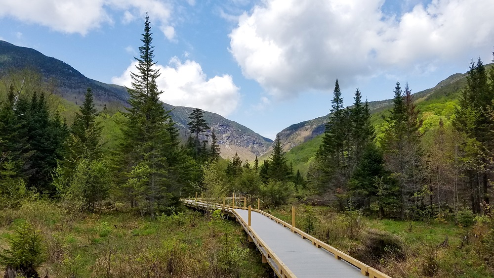
Beginning and ending at the Barnes Camp Visitor Center in Smugglers’ Notch, this 1.5-mile loop packs a wide range of surfaces and environments. In a counter-clockwise direction, the trail rises gently from Barnes Camp along the recently re-routed Long Trail. After gaining about 250 feet in elevation, take a left turn down the Barnes Camp Loop on the “old” Long Trail and drop steeply to a stream crossing. After testing your rock-hopping skills, take another left onto the “new” Long Trail and finish with gently rolling terrain and the beautiful Smugglers’ Notch boardwalk.
Town: Stowe
Distance: 1.5 miles
Surface: Technical singletrack and boardwalk
Elevation gain: ~300 feet

Brandon Gap to Bloodroot Gap Out-and-back
I’ve lost count of how many times I’ve heard this described as “the most boring part of the Long Trail.” I strongly disagree. From Brandon Gap to Bloodroot Gap, the Long Trail follows a side-hill contour and rises so gently that I consider it the most “runnable” section of the LT. When you can peek through the trees, the views to the east are vast and unlimited. Is it boring, or just misunderstood? Go see for yourself!
Town: Goshen
Distance: 6.6 miles
Surface: Old doubletrack and technical singletrack
Elevation gain: ~900 feet

Babcock Trail/Devil’s Gulch Loop
This hidden gem in Northern Vermont follows a lightly-used loop with some minor scrambling; together, these features make for a quiet outing that feels very remote. Starting and ending at the Long Trail parking at Eden Crossing, run counter-clockwise on the Babcock Extension and Babcock Trail to reach its junction with the Long Trail, passing Big Muddy Pond along the way. From here, run a short out-and-back southbound on the LT to scramble through the depths of Devil’s Gulch. When your scrambling desires are sated, return northbound on the LT to enjoy views of Ritterbush Pond from the lookout of the same name.
Town: Eden
Distance: 5.8 miles
Surface: Technical singletrack and light scrambling
Elevation gain: ~1000 feet

Lake Trail/Baker Peak/Long Trail Loop
In New England, some of the most pleasant running can be found on trails originally designed for horse travel, and the Lake Trail is an excellent example. This old bridal path, which climbs gradually but significantly from the Otter Creek valley, allows access to the views from Baker Peak and the pristine waters of Griffith Lake. I prefer to take the Lake Trail to the Baker Peak Trail to complete the full climb, then roll along the Long Trail to reconnect with the Lake Trail for a long, gradual descent. A short 0.1-mile side jaunt to Griffith Lake is optional, but well worth the extra effort.
Town: Mt. Tabor
Distance: 8.2 miles
Surface: Technical singletrack
Elevation gain: ~2200 feet
“New LT” and “Old LT” Bolton Loop
As a Richmond resident, this is my closest long mountain loop, and I enjoy the quiet wildness found on these rarely used trails. Starting and ending at the Long Trail parking on Route 2 in Bolton, run and hike up the newly minted Long Trail relocation along Stimson Ridge (real switchbacks!) to its intersection with the Duck Brook Trail (the “Old LT”). From here, drop steeply to Bolton Notch Road, then continue across the road to stay on the continuation of the Duck Brook Trail. Once through some selective logging areas, the trail bounces around a wooded ridgeline and passes a few remote beaver ponds en route to the beautifully situated Duck Brook Shelter. Towards the end of the trail, stop to take in the views from several open ledges. Eventually, Duck Brook Trail funnels down through a powerline cut and spills out onto Stage Road; from here, run down to Route 2 and enjoy a noisy mile of highway running to return to your starting point.
Town: Bolton
Distance: 12 miles
Surface: Technical singletrack, gravel road, paved road
Elevation gain: ~3500 feet


I wonder what a runner from 1876 would say if they bumped into a modern trail runner with current shoes, GPS, water bottles, bluetooth headphones, etc. Folks back then were probably running in cowboy boots!