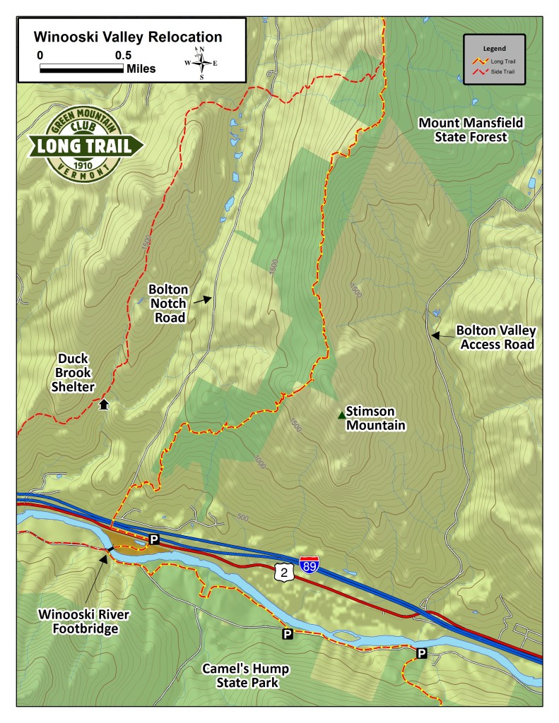
Long Trail Relocation through Winooski River Valley
Directions from Camel’s Hump Long Trail parking lot to the Long Trail North in Bolton
From the Camel’s Hump Long Trail parking lot at Duxbury Road, follow the Long Trail North (along the Duxbury Road) 1 mile to a parking lot on the north side of the road (the Winooski side).
Follow signs and white blazes along the bank of the Winooski River and through farm fields for 1.2 miles until climbing to rejoin the road 0.2 miles east of the new Winooski River Footbridge. A blue-blazed high water route brings hikers back up to the road on either side of a ford across Preston Brook.
Cross bridge and walk .25 mile through woods to railroad tracks and U.S. Route 2.
Carefully cross active railroad tracks and busy U.S. Route 2. You will see a trailhead parking lot located across the road.
Turn left and continue on Long Trail North running parallel with U.S. Route 2 for approximately .25 mile. Watch for white-blazed posts.
Turn right onto Bolton Notch Road/LT North. At tunnel, stop and press button to activate lighting system which will notify drivers that you are in the tunnel. When lights begin to flash, pass through tunnel.
Continue on Bolton Notch Road/LT North for another .25 mile. Watch for white blaze on right side of road. Enter the woods here and descend tread ladder.
Follow Long Trail North for approximately 4.65 miles to junction of old Long Trail (now blue-blazed side trail).
Continue north, following white blazes.
Note: Distance between Bamforth Ridge Shelter and Buchanan Shelter on new Long Trail is approximately 12 miles.


Leave a Reply