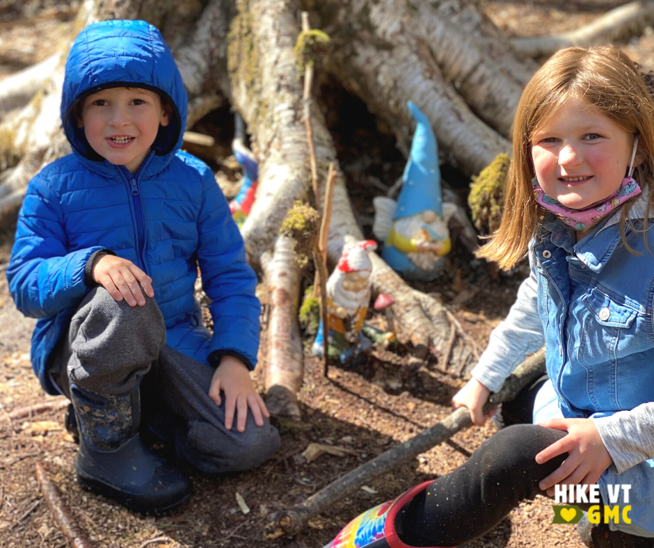
Let’s HikeVT! This week we’re recommending hikes that are perfect for families with children of all ages. These kid-friendly hikes are all easy enough for the smallest of hikers and have lots of interesting features like a Gnome home, puncheon and bridges, and rivers and ponds.
- Wiessner Woods, Stowe
- Short Trail, Waterbury Center
- Beane Trail, Huntington
- Appalachian Trail to Kent Pond, Killington
- Long Trail to Little Rock Pond, Mount Tabor
Wiessner Woods, Stowe
» 1.84 mi round trip, approx. 135 ft elevation gain
This easy trail system is managed by Stowe Land Trust. It has a few different length loops to try with many different features to see along the way including bridges, a sugarhouse, a vernal pool, different forest types, and most exciting of all is the Gnome Home!
Driving Directions from Stowe: Follow route 108 to turn right onto Edson Hill Road, pass the entrance to the Stowehof Inn, and take the next drive on your right. The Wiessner Woods trailhead is on your left. Map it.
Short Trail, Waterbury Center
» 0.7 mi round trip, approx. 54 ft elevation gain
Located behind the GMC Headquarters, the Short Trail gives visitors a taste of the Long Trail! Complete with white blazes, informational signs, puncheon, bridges, and even an old Journey’s End shelter, it is perfect for families with small children.
Driving Directions: From I89, take exit 10 and follow Route 100 North. The Green Mountain Club will be on your left past Cold Hollow Cider. Map it.
Beane Trail, Huntington
» 2.8 mi round trip, approx. 600 ft elevation gain
The Beane Trail comes highly recommended by 5-year old Lincoln, who enjoys hiking it with his dad Jason (GMC’s Director of Finance). This is also a great option for first time backpackers! From the parking area, walk past the iron gate and follow a farm road through open woods until an intersection where the Beane Trail transitions to a more traditional hiking trail. From here, the Beane Trail ascends at a gentle, steady pitch to Birch Glen Shelter.
Driving Directions:
From Bristol: Head north on VT-116 N/VT-17 E. At split, turn right on VT-17 E. After 6.9 mi, turn right on Gore Rd. After 2.9 mi, turn right on Carse Rd. At Moody Rd, take a quick right then quick left to stay on Carse Rd. After passing a large farm on your right, park by an iron gate on your left (do not block gate).
From Waitsfield: Follow VT-17 W up and over Appalachian Gap. 2.7 mi after height of gap, turn right on Gore Rd. After 2.9 mi, turn right on Carse Rd. At Moody Rd, take a quick right then quick left to stay on Carse Rd. After passing a large farm on your right, park by an iron gate on your left (do not block gate). Map it.
Appalachian Trail to Kent Pond, Killington
»1.2 mi round trip, approx. < 20 ft elevation gain
Follow the white blazed Appalachian Trail over a bridge, past a small waterfall, and along the shore of Kent Pond to end at Thundering Brook Rd. Return the way you came.
Driving Directions: From the VT-100/US-4 intersection in Killington, go about 0.4 miles north on VT-100. The parking for the trailhead is on the right. Map it.
Long Trail to Little Rock Pond, Mount Tabor
» 4.0 mi round trip, approx. 324 ft elevation gain
This easy section of the Long Trail gradually rises to Little Rock Pond. The pond is a great spot to swim, look for salamanders, and eat lunch. For a slightly longer trip, continue to follow the Long Trail north to the junction with the Little Rock Pond Loop Trail. Follow the loop trail along the shoreline back to the Long Trail.
Driving Directions: From the intersection of US-7 and Brooklyn Road in Danby, take Brooklyn Road east (USFS Road 10) for 3.2 miles to a paved parking lot on the right, 0.6 miles past the Big Branch Picnic Area. Start your hike near the sign board directly across the road from the parking lot. Map it.
Questions? Our visitor center staff is here to assist you. Call (802) 244-7037 or email [email protected].


