Let’s HikeVT! This week we’re featuring moderate- to difficult-level winter hikes throughout the state that can grow your winter hiking skills. Review proper layering, footwear, fuel, equipment, and safety planning with our everything winter hiking guide before you go.
- Bald Mountain, Westmore
- Laraway Lookout, Waterville
- Skylight Pond, Ripton
- Pico Peak, Killington
- Stratton Mountain, Stratton
Bald Mountain, Westmore – Moderate to Difficult
» 4.4 mi round trip, approx. 1,450 ft elevation gain
This mountain can be scaled by way of three different trails, but the Long Pond Trail provides the best overall approach (especially for a winter ascent). Beginning on a gated logging road, the first mile gradually climbs with some occasional ups and downs before becoming dramatically steeper as you approach the sub-alpine zone. The summit rises well above the many surrounding peaks in this region, and offers an expansive view of Vermont’s Northeast Kingdom from the fire tower atop its heavily wooded summit.
Driving Directions:
From its junction with Vt. 5A on the east side of Lake Willoughby, which is 1.4 mi. south of Vt. 16 in Westmore and 9.8 mi. north of U.S. 5 in east Burke, follow Long Pond Rd. 2.1 mi. to reach a large plowed parking area on the left.
Laraway Lookout, Waterville – Moderate to Difficult
» 3.6 mi round trip, approx. 1,390 ft elevation gain
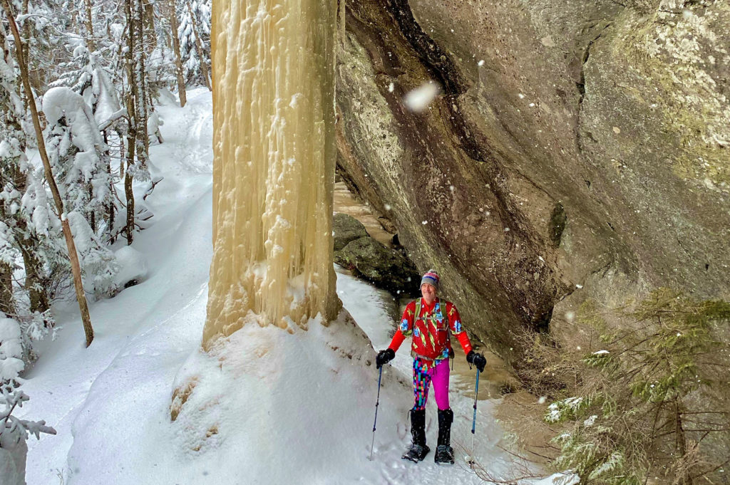
From the parking area, continue walking east on Codding Hollow Road until you reach a dirt pull-off on your left. Parking is allowed here in the summer. Start up the Long Trail north from the end of the pull-off. The trail mostly follows old woods roads for the first section of the hike, so be sure to keep an eye out for white blazes on the trees to stay on track. Eventually the trail begins traversing west along the slope of Laraway Mountain, passing under impressive overhanging cliffs where spectacular ice pillars form, caused by the continuous runoff of water from the top of the mountain. After the cliffs end, the trail climbs moderately to Laraway Lookout. Enjoy the view of the Champlain Valley before heading back the way you came.
Driving Directions to Codding Hollow Rd Long Trail Parking Lot:
From Jeffersonville: From the traffic circle, head north on VT-108 N. Cross the Lamoille River and turn right on VT-109. 1.5 mi after passing the Waterville Town Hall, turn right on Codding Hollow Rd and pass through Jaynes Covered Bridge. Bear right on Codding Hollow Rd when Clark Rd splits off to the left, then bear left on Codding Hollow when Lock Rd splits to the right. Codding Hollow Rd grows narrower and narrower, finally reaching a dirt parking lot on your right.
From Morrisville/Johnson: Head west on VT-15 W. Bear right on Hogback Road after passing Dollar General. When Hogback Rd ends, bear right on VT-109. See directions above.
Map it*
*This parking lot is NOT accessible by car from the east end of Codding Hollow Road. You MUST access lot from the west end in Waterville.
Skylight Pond, Ripton – Moderate to Difficult
» 7 mi round trip, approx. 1,650 ft elevation gain
From the northeast corner of the parking lot, the route follows a VAST snowmobile trail south (right) a short distance, then continues east along USFS Rd. 59 through nice hardwood forest for about a mile before arriving at the summer parking lot on the left. From there, follow the blue-blazed Skylight Pond Trail through mixed hardwoods of maple, beech and yellow birch. Take care to follow the blue blazes as the trail is crossed by several logging roads along the way. The trail climbs steadily with a series of switchbacks. The final pitch steeply climbs to the top of the ridge where a signed junction with the Long Trail is found. Straight ahead is the spur trail to Skylight Pond. This gorgeous high-elevation pond will be a smooth expanse of snow and ice, but the setting is lovely all the same. On a hillside above the pond sits Skyline Lodge. It provides a fine place for lunch and a rest before the return hike.
Driving Directions:
From the center of Ripton, follow U.S. Forest Service Rd. 59, also known as the Natural Turnpike, for approximately 3.5 mi. Bear left at a junction with USFS Rd. 54 and follow to a usually well-maintained and spacious parking lot on the right. Beyond this point, both USFS roads are closed from December 15 until the surface firms after the spring thaw.
Pico Peak via Sherburne Pass Trail, Killington – Moderate to Difficult
» 5.5 mi round trip, approx. 1,860 ft elevation gain
From the parking area on Route 4, the Sherburne Pass Trail gradually climbs 2.7 miles to Pico Camp, a small four-sided shelter. Ski trails allow for nice views along the way. From the camp, follow the Pico Link trail 0.4 miles up to Pico’s open summit.
Driving Directions:
Via Public Transit: The “Rutland Killington Commuter” bus route of the Marble Valley Regional Transit District (aka The Bus) stops at the Inn at Long Trail across the street from the Sherburne Pass Trail parking lot. See www.thebus.com for route schedules and times, which are subject to change.
From Rutland: From the US 7/US 4 intersection, drive east on US 4 until the highest point of Sherburne Pass. Parking lot will be on your right across from The Inn at Long Trail.
From Killington/Woodstock: Drive west on US 4 until the highest point of Sherburne Pass. Parking lot will be on your left across from The Inn at Long Trail.
Stratton Mountain, Stratton – Moderate to Difficult
» 7.6 mi round trip, approx. 1,706 ft elevation gain
Starting from the Long Trail/Appalachian Trail parking lot, head north 3.8 miles on the Long Trail to the summit, passing views at several places along the way. A 70-foot fire tower, originally built by the CCC and renovated in 2011 by the Long Trail Patrol, sits atop the summit, offering 360° views.
Driving Directions to Long Trail/Appalachian Trail Parking Lot:
*From Wardsboro: Take 100-S out of town. Turn right on Stratton Arlington Road (also known as Kelley Stand Road). After 6.9 mi, you will see the parking lot on your right, with an informational kiosk and LT/AT sign.
*You must approach from Wardsboro because Stratton-Arlington Road is closed in the winter from the Manchester side.
Maps:
Places to rent snowshoes:
- Umiak Outdoor Outfitters, Stowe
- Outdoor Gear Exchange, Burlington
- First Stop Board Barn, Killington
- The Mountain Goat, Manchester
- VT Libraries with Snowshoes through Rise VT
Questions? Our visitor center staff is here to assist you. Call (802) 244-7037 or email [email protected].


