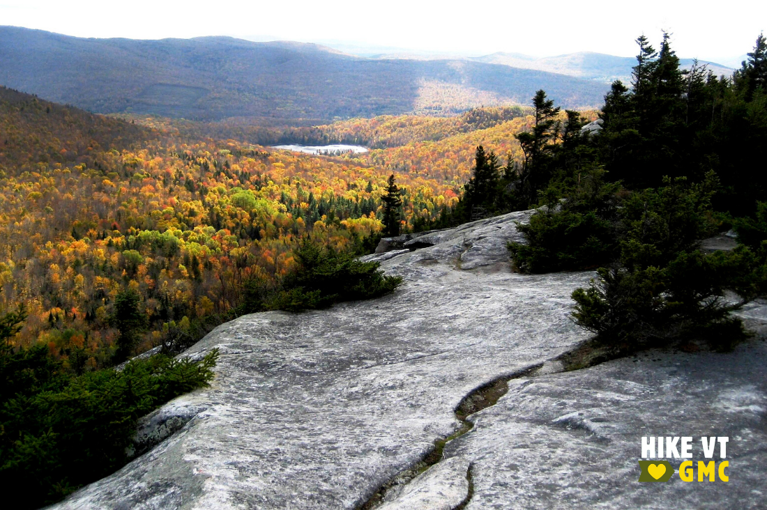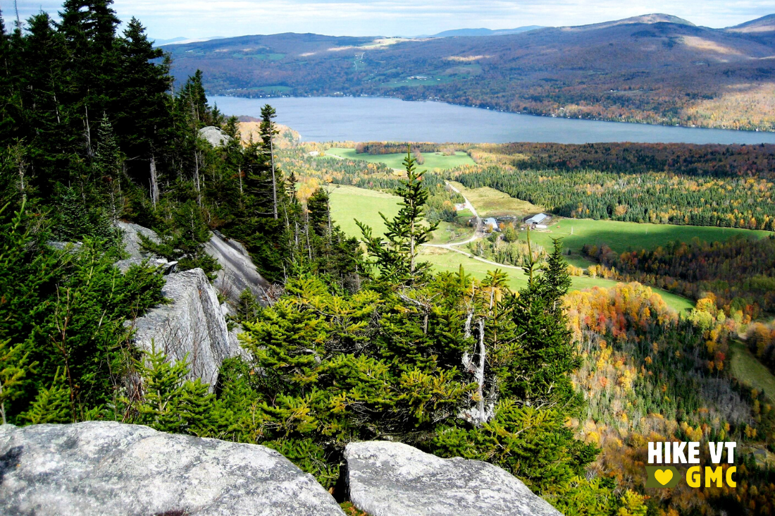
Let’s HikeVT! This week, we’re kicking off the changing seasons with the best leaf peeping hikes in Vermont’s Northeast Kingdom. Try these hikes in the quieter corner of the state for brilliant colors that show early in the season. Don’t forget to bring your camera and share your photos online: #HikeVT!
- Brousseau Mountain, Norton
- Bluff Mountain, Island Pond
- Haystack Mountain Loop, Westmore
- Wheeler Mountain, Barton
- Sentinel Rock Trail, Westmore — Easy, Accessible
Brousseau Mountain, Norton
» 1.8 mi round trip, approx. 592 ft elevation gain
The trail begins by taking hikers through an open meadow before leading into a recently cut forest and winding through the woods for a time. Near the summit, the trail winds over granite bedrock and then to the forested peak. A short distance further, there is a cliff lookout that provides extensive views to the south and east.
Please note that this trail passes through private property. Please respect the landowner and protect future access by staying on the marked trail and following all rules.
Driving Directions: From Norton, drive east on VT-114 N for 2.9 miles. Turn right onto Brousseau Mountain Road and continue to the gated terminus. Parking is limited, so please pull off the road completely without blocking the gate or camp access. From the gate, continue straight up the access road where, shortly, trailhead signs will appear on the left. Map it.
Bluff Mountain, Island Pond
» 3.1 mi round trip, approx. 1,074 ft elevation gain
A lollipop loop can be made by following the Bluff Mountain Community Trail to the Lookout Trail to the summit; then follow the Bluff Mountain Community Trail all the way back to the trailhead.
The Bluff Mountain Community Trail steadily winds its way up over small ridges and outcrops to the Lookout Trail. Follow the Lookout Trail as it climbs more steeply over rocks and boulders past a stunning lookout on the way toward the summit. From the summit, follow the mellower Bluff Community Trail back to the trailhead.
Driving Directions: From central Island Pond, drive north on VT-105/East Brighton Road for 0.3 miles. Turn left onto Curran Avenue and continue for 0.2 miles. Turn right onto Mountain Street and continue for about 0.5 miles after the road turns to dirt. There is a parking lot on the side of the road for a small number of cars. The trailhead is located off the parking lot. Map it.
Haystack Mountain Loop, Westmore
» 3.2 mi round trip, approx. 879 ft elevation gain
Although Haystack Mountain is a small mountain, it is rugged and steep from both trails. The peak is accessible from the north and the south and offers views towards Long Pond, Bald Mountain, and beyond.
A loop can be made by connecting the North Trail, South Trail, then returning on the Long Pond Road to the trailhead. The North Trail begins with a moderate climb through an open hardwood forest then the slope becomes steeper as it leads up to a knoll. The trail comes to an intersection with a spur trail that offers views of Long Pond and Lake Willoughby. Continuing straight, the North Trail soon reaches the summit (marked with a large rock pile) and converges with the South Trail. Continue on the South Trail as it descends by two lookouts on the way to Long Pond Road. Turn right onto the road to return to the trailhead for the North Trail.
Driving Directions: To the North Trail parking, head north on VT-5A. Turn right onto Long Pond Road and proceed for 2.5 mile. There is roadside parking at the trailhead. Map it.

Wheeler Mountain, Barton
» 4.4 mi round trip, approx. 700 ft elevation gain
Starting from the new trailhead that is found 0.2 miles past the trailhead for Moose Mountain and Wheeler Pond Trail, the Wheeler Pond Trail gradually climbs through the woods following the contours of the ridgeline. This leads you to an easy hike over open ledges with expansive views. From here, the trail enters the woods following open bedrock to the top of the Wheeler Mountain cliffs that provide views of Jay Peak and Mansfield. The trail then continues through the woods past the summit to Eagle Cliff which provides views Lake Willoughby and Mt. Pisgah.
Driving Directions: From Lyndon: Head north on US-5 N. Stay left on US-5 N when 5A splits off in West Burke. 8.3 mi after that split, turn right on Wheeler Mountain Road. After .9 mi, you will see a dirt pull off on your right with a wooden GMC sign. Please do not block the gate when parking. If full, please park in the dirt pull-off on the west/left side of the road just before the main lot.
From Barton: From Barton, drive south on VT-5/Lake Street for 4.5 miles. Turn right onto Wheeler Mountain Road and continue for 1.4 miles. Pull off to the right into the parking lot. The trail leaves from the parking lot then crosses the road to head west. The parking area is not plowed in the winter. Map it.
Sentinel Rock Trail, Westmore – EASY, ACCESSIBLE
» 1.8 mi round trip, approx. 26 ft elevation gain
This easy and accessible trail leads to a grassy knoll that provides sweeping views of the Northeast Kingdom. Along the way, the trail passes by Sentinel Rock, a large glacial erratic that dates to 13,000 years ago. More info.
Driving Directions to Sentinel Rock State Park: From Lyndon: Head north on US-5 N. Bear right on US-5A when it splits off in West Burke. After passing most of Lake Willoughby, turn right on Hinton Hill Rd/T-38 at the Westmore Community Church. Head up the hill and a dirt parking lot will be on your left in a large field.
From Newport: Head south on I-91S and take exit 26. Turn left US-5 S/VT-58 E and stay on VT-58 E when they split. When 58 ends, turn right on US-5A S. Turn left on Hinton Hill Rd/T-38 at the Westmore Community Church. Head up the hill and a dirt parking lot will be on your left in a large field. Map it.
Questions? Our visitor center staff is here to assist you. Call (802) 244-7037 or email [email protected].


