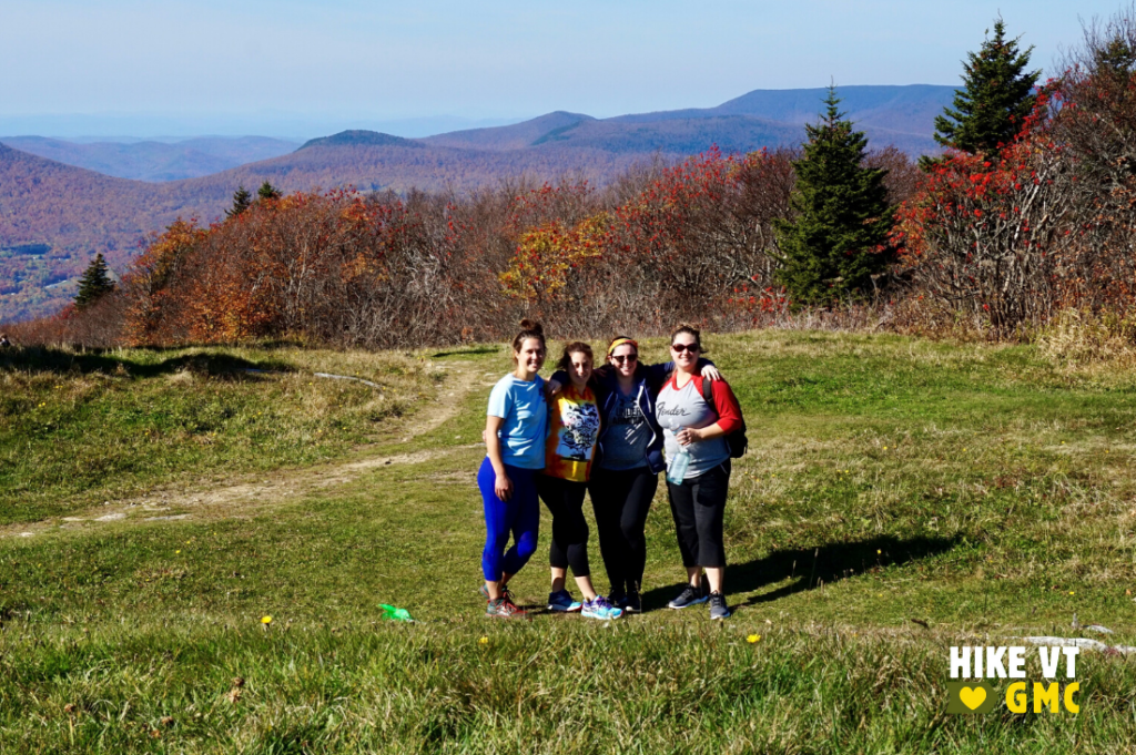
Let’s HikeVT! This week, we’re exploring the best foliage hikes in and around Manchester. This southern-VT destination offers a range of accessible and moderate hikes, complete with amazing leaf-peeping opportunities. Check out our fall hiking safety tips, grab your camera to share your photos online (#HikeVT), and have fun hiking out there!
- Bromley Mountain, Winhall
- Baker Peak, Peru
- Prospect Rock, Manchester
- Stratton Pond Trail, Stratton
- Hildene Boardwalk, Manchester — Easy, Accessible
Bromley Mountain, Winhall — Moderate
» 6.0 mi round trip, approx. 1,460 ft elevation gain
Follow the Long Trail north as it gradually climbs past Bromley Shelter. It then climbs more steeply to the summit where you will find yourself surrounded by the foliage and views from every angle. The grassy, open ski trails make it a wonderful spot to relax and eat lunch.
Driving Directions: From Route-7 in Manchester, take exit 4 and follow Route-11/30 west for 4.5 miles until you reach the Long Trail parking lot on the left. Map it.
Baker Peak via the Griffith Lake Trail and the Long Trail — Moderate
» 8 mi round trip, approx. 270 ft elevation gain
At the end of the Griffith Lake Trail, turn left on the Long Trail/Appalachian Trail North. Stay on the white-blazed LT/AT as it passes several side trails while gradually climbing towards the peak. From the open rock summit, you will have a panoramic view of the Great Valley of Vermont. On a clear day you can see the Adirondacks to the west, Killington Peak to the north, and Stratton Mountain with its firetower to the south. Return on same route, paying careful attention at intersections.
Driving Directions: From Manchester: Head east on VT-11/30 and stay on VT-11 when it splits from VT-30. Soon after passing Bromley Ski Area, bear left on Main Street and turn left on Hapgood Pond Road in the village. At the fork, bear left on N Road. Turn left on Mad Tom Notch Road (Forest Road 21), drive approximately 2.0 miles, and turn right onto Forest Road 58. Continue to the gate at the end of the road. Do not block the gate while parking.
From Londonderry: Head west on VT-11 and turn right on Lovers Lane before reaching the village of Peru. At the four-way intersection, take a right on Hapgood Pond Road, then an immediate left on N Road. Turn left on Mad Tom Notch Road (Forest Road 21), drive approximately 2.0 miles, and turn right onto Forest Road 58. Continue to the gate at the end of the road. Do not block the gate while parking. Map it.
Prospect Rock, Manchester — Easy
» 3.6 mi round trip, approx. 1,000 ft elevation gain
This easy trail follows Old Rootville Road for 1.8 miles to an intersection with the Long Trail. Continue 50 yards south to a rocky outcrop on the right that provides lovely views of Manchester, the Battenkill River Valley, Mount Equinox, and Dorset Peak.
Driving Directions: From Manchester Center, follow Route-30/11 to turn right onto East Manchester Road. Continue straight onto Old Rootville Road for about 0.5 mi until you reach a small parking area. Map it.
Stratton Pond via the Stratton Pond Trail — Moderate
» 7.4 mi round trip, approx. 400 ft elevation gain
From the parking lot, head north on the gently rolling Stratton Pond Trail. At approximately 1 mile from the parking lot, you will pass an intersection where the Catamount Trail joins the same route. After another approximately 2.5 miles, you will come to an intersection for Stratton Pond Shelter. Turn left, and then turn left again (almost immediately) once you reach an intersection with the LT/AT. From here it is only .1 mi down to the beautiful Willis Ross Clearing on the shore of Stratton Pond. Ponds are a great alternative to high elevation views to see the beautiful foliage!
Driving Directions: From Manchester: Take US-7 south until exit 3. At the exit, turn right onto 313 W and then take an immediate right on South Road. At end of South Road, turn right on Kansas Road. Cross under US-7 and turn right on Kelley Stand Road (also known as Stratton Arlington Road). After 9.5 miles, turn into the parking lot on your left. Map it.
Boardwalk at Hildene, Manchester — Easy / Accessible
» 600 ft, approx. 19 ft elevation gain
This accessible trail offers both wildlife-viewing and history. Hildene is the privately-managed estate of Abraham Lincoln’s son, Robert. The estate’s trail system includes a 600-foot, floating, accessible boardwalk over a wetland where you might spot turtles, frogs, and herons.
Please note the boardwalk is accessed via a grass wagon path which may not be passable by all mobility aids. Find info about admission fees and hours online.
Driving Directions: From Manchester: Head South on VT-7A from the center of town. Turn left on Hildene Road. The Welcome Center will be on your left. Map it.
Questions? Our visitor center staff is here to assist you. Call (802) 244-7037 or email [email protected].


