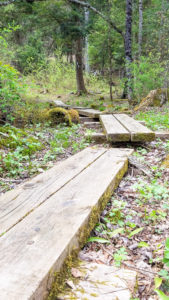
Mud Season is that New England special time considered to be the ~ six weeks between spring thaw and Memorial Day Weekend, when we advise hikers to stay off muddy trails to prevent erosion, widening, and other damage to the hiking environment. Please plan ahead and prepare when going for any hike. We strongly suggest that hikers carry a map and guidebook when heading out to the trails. Guidebooks and maps are available for purchase at GMC’s Visitor Center, GMC’s online store, and in most Vermont bookstores and outdoor gear retailers.
Would you like to join a group for a hike? GMC’s fourteen sections lead outings every week all over Vermont. Check out our calendar to join them.
Below are some suggested mud season hikes around Vermont, all of which can be found in GMC guidebooks. GMC’s Day Hiker’s Guide describes more than 150 trails to mountains, scenic ponds and waterfalls, and nature trails in the Green Mountains and beyond. In the Long Trail Guide, you will find detailed maps and descriptions of the Long Trail System and the Appalachian Trail in Vermont, suggested day hikes, shelter descriptions, and public campgrounds near the trail. The Walker’s Guide to Vermont includes shorter walks and leisurely rambles around the state. We also now have a list of more accessible trails in Vermont.
Please keep in mind that conditions change frequently during mud season and even trails listed here may not be appropriate to hike at any given time. Find out more about mud season to be able to make responsible choices on which trails to hike and when to turn around.
Northern:
Burlington Greenway, Burlington: This 7.6-mile multi-use path follows Burlington’s waterfront. Whether hiking or biking, outdoor enthusiasts are provided with beautiful views across Lake Champlain to the Adirondack Mountains.
Stowe Recreation Path, Stowe: This 5.5-mile paved path winds along the west branch of the Waterbury River through the beautiful town of Stowe. It is a great option for biking or walking while enjoying views of Vermont’s highest mountain, Mt. Mansfield.
The VYCC Trails, Richmond: This easy 3-mile trail system is located on a low-elevation, south-facing slope, which is ideal for mud season. The Richmond Trails Committee oversees many other family-friendly and mud season friendly hikes within the Richmond area.
South Shore Trail, Willoughby State Forest: This almost 2-mile loop skirts the edge of the beautiful Lake Willoughby. This easy trail only gains about 200’ of elevation making it a nice option for novice hikers.
Southern:
Recreation in the Shires, Bennington: From hiking to biking and wildflowers to beautiful views, there are a variety of trails found in the Bennington area that are great mud season options for people of all abilities.
Long Trail to Spruce Peak, Winhall: This 2.4-mile section of the LT gradually winds from Route 11/30 to the summit of Spruce Peak where a view of the Taconic Range is found. Continue south on the LT for another 0.4 mile and have lunch at Spruce Peak Shelter. Return the way you came.
Homer Stone Brook Trail, South Wallingford: For those working on their side-to-side trails, the Homer Stone Brook Trail is a good mud season choice. The 2.3-mile trail gradually approaches the scenic Little Rock Pond. From here you can then circumnavigate the pond and even have lunch at the shelter. Please be aware the stream crossing can be difficult during high-water events or conditions.
Prospect Rock, Manchester: The trail steadily ascends Old Rootville Road 1.8 miles to a rocky outlook. From there, hikers are rewarded with views of Manchester and Mt. Equinox.
Black Mountain, Dummerston: Owned by The Nature Conservancy, this 1,280’ mountain is a granite pluton, or in other words, a volcano that never erupted. Along the 1.8-mile trail, hikers can experience plant communities that are rare to Vermont including mountain laurel that blooms each June.
Eastern:
Upper Valley Trails Alliance, Norwich: The UVTA oversees an array of trails throughout the Upper Valley that are appropriate for mud season. With so many choices available, any hiker should be able to find a trail that matches their ability.
Quechee Gorge Trail, Hartford: This easy 1.1-mile trail descends to the bottom of the infamous Quechee Gorge. From here, get a first-hand look as the rushing waters become a placid river at the upstream end of the North Hartland Reservoir.
Appalachian Trail from Gifford Woods State Park to River Road, Killington: This 2.7-mile section of the AT travels along the south shore of the beautiful Kent Pond. It then gradually descends through the woods to the Thundering Falls universally accessible spur trail, which leads to the base of a waterfall.
Mt. Ascutney, Windsor: For hikers seeking to gain some elevation during mud season, the parkway up Mt. Ascutney is a great option. The auto road provides a durable surface that winds up the mountain for 3.7 miles and provides many viewpoints along the way.
Mt. Tom, Woodstock: Located in the Marsh-Billings-Rockefeller National Historic Park, this small mountain provides beautiful views of the town of Woodstock. Follow Mountain Rd to Mount Tom Rd to reach the summit in 4 miles.
Western:
Mount Independence, Orwell: This small hill was an important defense point during the American Revolution and is thus loaded with history, including archeological remains of brigade encampments, general hospitals, soldier huts, and battery defenses. All the trails are easy to moderate and the summit provides a commanding view of Lake Champlain and Fort Ticonderoga.
Mt. Philo, Charlotte: This small mountain is found in Mount Philo State Park which is the oldest park in the state system. The short hike to the summit provides spectacular views of Lake Champlain and the Adirondacks. Great for all abilities.
Delaware and Hudson Rail Trail: This 19.8-mile multi-use trail travels through Bennington and Rutland counties. Walkers can experience a variety of scenery as it passes by dairy farms; through meadows, forests, and wetland; and traverses 17 bridges and overpasses.


