

 If you’re looking for some new-to-you trails and to discover little-visited corners of Vermont, the Long Trail (LT) Side-to-Side challenge might be perfect for you.
A cousin of the End-to-End hiking challenge, the Side-to-Side Challenge was born in 2006 after years of hikers informally taking it on. Hiking the Vermont Side-to-Side challenge is a great way to mix up your standard hiking routes.
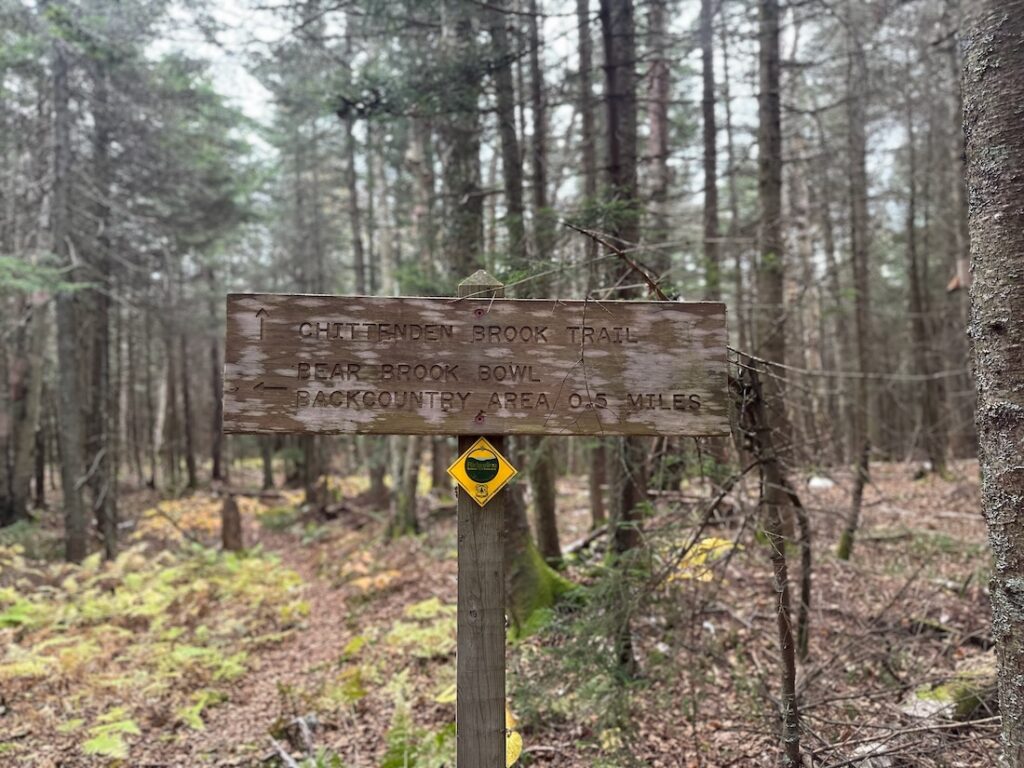
It consists of 88 side trails — 84 that the Green Mountain Club (GMC) manages, and a few we don’t, like the Wanderer Trail at Stratton Mountain Ski Resort — and covers 166.1 miles. These trails are mostly blue-blazed and generally extend from a trailhead to the LT itself.
There have been just 71 Side-to-Siders to date. Each year, we recognize about one percent of the total number of End-to-Enders, so joining the ranks of the Side-to-Siders places you in elite company.
Many of you are probably well on your way to completing the challenge and may not even know it. Certification is simple – we just ask for the approximate date hiked for each of the 88 side trails, conveniently organized in a digital tracker that includes the divisions used on the Long Trail Map. So grab our latest map and a Long Trail Guide for directions and trail descriptions and start plotting some routes to explore side trails that are new to you!
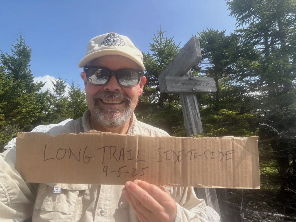
Hiking expert Philip Werner moved to Vermont in a few years ago and began working on his Side-to-Side certification as a way to explore his new home. He completed the challenge in September 2025 and documented his approach to itinerary planning and exploring on his website, sectionhiker.com.
Philip first heard about the Side-to-Side Challenge from a friend who had previously worked on a GMC trail crew and had completed it. He recommends using a Side-to-Side list to eliminate some of the endless browsing and choice.
“I’m a list hiker, I love having a list to take some of the guesswork out of where to hike each week,” he explains.
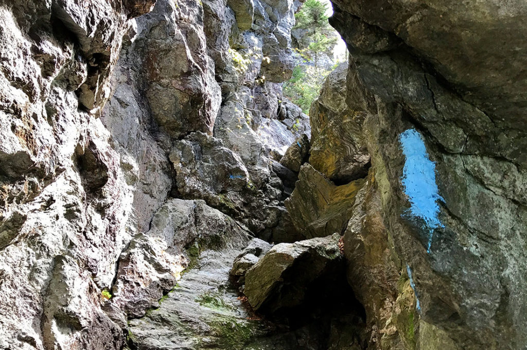
 Side trails vary widely, from treacherous crawls through caves on Mount Mansfield’s rugged ridgeline, to gentle strolls to ponds in southern Vermont. Philip says it’s a great way to explore the variety of terrain that hiking in Vermont has to offer and keep your hiking experience fresh.
There’s no one way to approach the Side-to-Side Challenge. You could do 88 separate day hikes or try to combine multiple trails in a vicinity into one long day’s hike or a multi-day backpacking trip. No matter what, you’ll be hiking more than the designated 166.1 miles, since there are a few loop options and most trails will be hiked in some sort of out-and-back manner.
“Generally you will find fewer hikers which, for me, is a delight. Also, there’s a better chance of seeing Vermont’s wildlife because it’s quieter with the decrease in foot traffic. — Ira Sollace, Side-to-Side 2020
“You will drive yourself crazy trying to figure out the optimal route to get as many trail miles as possible,” admits Philip.
One strategy is to start with the trails nearest your home, to keep the activation energy low, and build up to trail areas that will require longer drives or nights away from home.
Jake Perkins, who completed the challenge in 2024 offers this approach: “Treat it as a long-term commitment and incorporate the hikes into other experiences in the surrounding woods and towns.”
Philip created backpacking routes using GMC’s hiking maps for networks of trails on Killington, Camel’s Hump, and Mount Mansfield. “They’re not traditional backpacking trips, because you’re doing a lot of in-and-out, back-and-forth to get to all the trails.” For example, over two days in the Killington Area, Philip hiked the following route:
Day One: Shrewsbury Peak Trail (3.8 mi.) to LT North (1.8 mi.), then down and back up the Bucklin Trail (3.5 mi. Each way, 7.0 mi. Total) before tenting overnight at Cooper Lodge.
Day Two: Killington Spur out-and-back to the summit, LT South (1.8 mi.) to Shrewsbury Peak Trail (again) to the Black Swamp Trail (2.1 mi.), and a 1.5 mi. road walk back to his car.
That’s a total of 19.5 miles of hiking for three side trails totaling 9.8 miles.
For Philip, planning is part of the fun of the challenge. A longtime New Hampshire resident, Philip was contemplating a move to Vermont a few years ago and used the Side-to-Side Challenge to explore the numerous back roads leading to some of the lesser-used trailheads. “Exploring Vermont this way has been thrilling, rekindling the joy I feel when driving down unmarked dirt roads in the middle of nowhere to hike on new trails to new destinations,” he says.
“I loved the logistics puzzle as a solo hiker and sometimes self-shuttled between trailheads with a bicycle and car.”
— Liz Ford
Philip had trail highlights from the entire length of the system but he can’t name a single favorite.
Trails to ponds and streams, like Little Rock Pond and Griffith Lake, were memorable for their peaceful destinations. The twisty, scrambly Canyon and Cliff Trails on Mansfield are perennial favorites among Side-to-Siders.
George Grzyb, who completed their Side-to-Side in year, recommends the Frank Post and Forester’s Trails because “they provided for a scenic loop to visit both Tillotson Peak and Belvidere Mountain in a quieter part of the Long Trail System,” says George. “There are many opportunities to combine a few side trails and revisit your favorite Long Trail destinations.”
In addition to GMC’s hiking maps, including the online Avenza versions, Philip swears by a road atlas. “You can’t rely on Google or Apple Maps for this challenge,” he says. Having a hiking buddy and dropping a second car somewhere can eliminate the number of out-and-back hikes necessary.
“I think more people should pursue the Side-to-Side list. It’s an on-ramp to the Long Trail itself; it’s a great way to stay connected to the trails after an End-to-End, and it can be very family-friendly and flexible since it doesn’t follow a traditional through-hike structure,” Philip concludes.


Leave a Reply