This article previously appeared in the Winter 2017 Long Trail News.
Green Mountain Club volunteer corridor monitors help to protect the Long Trail, the Appalachian Trail, and the diverse wildlife habitat of the Green Mountains, all while exploring remote areas in Vermont.
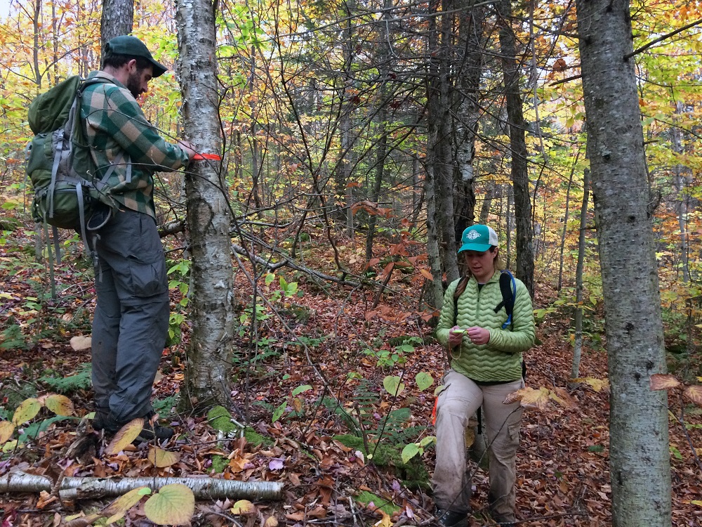
Along the Long Trail, volunteers adopt properties that the club has protected, either by purchase or by holding conservation easements. These properties form a corridor of land of varying width, which the trail traverses. Corridor monitors visit their properties at least twice a year, monitor them to make sure the terms of the conservation easement are being followed, and maintain boundary lines.
Recently two new sets of volunteers joined our corridor monitor team: Dan Potter and his wife, Amy, GMC’s Visitor Center manager; and Hannah Hutchinson and her husband, Lenny, GMC’s database manager. Dan and Amy will monitor the Big Jay tract, and Hannah and Lenny will monitor the Jay Peak tract. Our new volunteers walked their properties with Land Stewardship Coordinator Mollie Flanigan this fall.
Big Jay
By Dan Potter
As an avid outdoor recreation enthusiast, I believe we should all be stewards of the places we love, but I have only recently started walking the walk. Literally.
Club membership is a great method of support, but Amy and I recently took it to the next level and volunteered as corridor monitors. I hope our involvement will help ease the pressure on our resources as outdoor recreation continues to grow in popularity.
We chose to monitor the Big Jay parcel; the tract is surrounded by land conserved and owned by the State of Vermont and GMC. Neighboring parcels include the 3,764-acre Black Falls Basin (protected in 2001 and the largest land acquisition project ever undertaken by GMC), and Jay Peak, which is owned by the state and hosts some of Jay Peak Resort’s ski trails.
The Big Jay parcel is 1,572 acres, and stretches from Route 242 to the western flanks of Big and Little Jay peaks. It hosts half a mile of the Long Trail and Jay Camp Shelter.
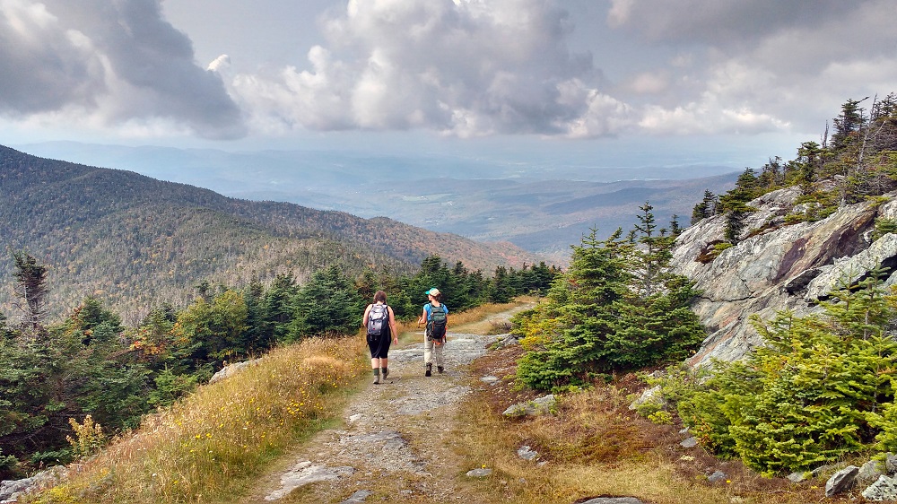
On our visits we will ensure that the terms of the conservation easement are being met; locate, walk, and mark the boundaries; and assess usage. On our first visit this fall with Mollie, we took the tram to the summit of Jay Peak and hiked to Big Jay. The trail to Big Jay evolved through repeated use, and it is not a designated trail. Big Jay is, however, on the AMC New England Hundred Highest peak bagging list, so the trail sees a fair amount of traffic. It winds through dense spruce-fir forest along the ridge between Jay and Big Jay.
On our walk with Mollie, we went to see the “scar” on the eastern flank of the mountain, which made headlines in 2007 when two people illegally cut more than 750 trees along a swath of forest approximately 2,000 feet long in the glacial cirque between Jay and Big Jay for backcountry skiing. A backcountry skier myself, this was of special interest to me. One of our main duties will be to visit this area to monitor for any further illegal cutting.
Near the top of Big Jay, we looked for but failed to find the boundary line. We were not too surprised, because the last boundary maintenance had been done decades ago. Hoping for better luck, we traveled to the Long Trail at Route 242 to search for the pin marking that corner of the property. It was hard to find, even with a GPS and a survey map of the property. But after thrashing around in the woods a while we found it! We then bushwhacked through the woods to flag and repaint that boundary.
Amy and I are grateful for the chance to learn new skills, engage with the landscape in a deeper way, and visit a place we probably would not visit otherwise (OK, maybe when there is enough snow!). It feels good to give back to a community and an organization that has protected many of the places I cherish in Vermont, especially in such a rewarding and adventurous way.

Jay Peak
By Hannah Hutchinson
If you just looked at the sky, you might have imagined it was August—a bluebird day, as it’s affectionately known. And, unlike most mid-winter days in Vermont, there was no wind. The silence was remarkable considering that Lenny I had only traveled half a mile into the woods away from the flurry of activity at the summit of Jay Peak Resort.
Fresh fluffy snow covered the trees and forest floor. As we made our way around the woods, passing the well-known Beaver Pond Glades, we did so more for the quiet of the winter woods and the adventure of unmarked terrain than the thrill of long carves. We were exploring, excited to check out the Jay Peak tract—corridor land that we had recently volunteered to monitor for GMC.
The next September Lenny and I headed back for official training with Mollie.
Mollie told us that a three-way land swap among GMC, Jay Peak Resort, and the State of Vermont had resulted in the Jay Peak tract, protecting two miles of the Long Trail and 166 acres of alpine forest. Our job would be maintaining the boundaries of the tract and alerting the club of encroachments, such as the cutting of trees to create glades or ski trails.
On this outing, we carried compasses and orange paint. We learned how to use—really use—a compass off trail as we followed official survey maps, quadrant bearings, and orange blazes on trees. Mollie explained that only licensed surveyors could legally establish the boundary line markings we followed, but volunteers can repaint them. Surveyors blaze trees with axes, making flat spots by peeling off bark and a little wood, then paint the blazes orange. They also set metal rods at the corners of the property.
The three of us set out to find the short metal rods. Once we found them and got our bearings we got to work repainting faded blazes, replacing old flagging (florescent-colored plastic tape commonly used by land managers), and compared what we saw with what we had studied in the Jay Peak tract baseline documentation report—the club’s official document containing the history, policies, and needs of the tract.
Lenny and I are elated to be able to monitor a corridor surrounding Jay Peak’s summit. We ski and splitboard at Jay most weekends, and our now twice-yearly outings for GMC not only give us the chance to be stewards of the land, but the opportunity to scout promising backcountry to ski.
After our day with Mollie, we went home covered with scratches and mud—exactly how all good adventures should end.

If corridor monitoring sounds like a rewarding volunteer opportunity to you, contact Conservation Manager Mollie Flanigan at [email protected] or (802) 241-8217 to learn more.


Leave a Reply