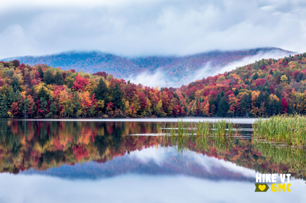
Let’s HikeVT! This week, we’re exploring the best foliage hikes in the Killington area. This hiking destination offers a range of trails with amazing leaf peeping opportunities. Check out our fall hiking safety tips, grab your camera to share your photos online (#HikeVT), and have fun hiking out there!
- Deer Leap Loop, Killington
- Bald Mountain, Killington
- Shrewsbury Peak, Shrewsbury
- Thundering Falls to Kent Pond, Killington
- Thundering Falls Boardwalk, Killington— Easy, Accessible
Deer Leap Loop, Killington — Moderate
» 3.5 mi round trip, approx. 650 ‘ft elevation gain
The Deer Leap Trail is a relatively short, but rugged, hike to the top of a rock outcrop with impressive views of the Coolidge Range and Sherburne Pass. The trail starts on the north side of US-4, at the east end of the Inn at Long Trail parking lot. Climb steadily for .5 miles until you intersect with the Appalachian Trail. Turn left and follow the AT for about 200’, at which point the Deer Leap Trail turns left and climbs .4 mi to the Overlook Spur, which leads .2 mi to the lookout.
To extend your hike, try the 3.5 mi Deer Leap loop! From the Overlook Spur, continue .9 mi on the Deer Leap until you intersect with the AT again. Turn right (AT north) and follow the AT .8 mi back to the original intersection. Turn right on the Deer Leap Trail to return to the parking lot.
Note: There are a few parking spots for hikers at the Inn at Long Trail, but plenty of room at the Sherburne Pass Trail across the street.
Driving Directions: Via Public Transit: The “Rutland Killington Commuter” bus route of the Marble Valley Regional Transit District (aka The Bus) stops at the Inn at Long Trail across the street from the Sherburne Pass Trail parking lot. Check here for route schedules and times, which are subject to change.
From Rutland: From the US-7/US-4 intersection, drive east on US-4 until the highest point of Sherburne Pass. The parking lot will be on your right across from the Inn at Long Trail.
From Killington/Woodstock: Drive west on US-4 until the highest point of Sherburne Pass. The parking lot will be on your left across from the Inn at Long Trail. Map it.
Bald Mountain, Mendon— Moderate
» 4.2 mi round trip, approx. 738 ft elevation gain
The Bald Mountain Trail starts on the access road before turning into the woods to start the ascend uphill. After about 0.5 mi, the trail splits to form a lollipop loop. Either direction will lead you over both the northern and southern summits, past several vistas where you can view the foliage in the surrounding valleys and mountains.
Driving Directions: From the US-7 and US-4 intersection in Rutland, follow Route-7 south to the traffic light at Killington Avenue. Turn left onto Killington Avenue. Follow for 1.8 miles to its end and turn right onto the paved Notch Road. In about 2 miles, the Bald Mountain trailhead is on the right. Park on the shoulder. Additional parking is available just past the trailhead on the right. Map it.
Shrewsbury Peak, Shrewsbury — Moderate
» 3.8 mi round trip, approx. 1,359 ft elevation gain
If you are in the Rutland or Killington area but want to avoid the crowds around Mt. Killington and Pico Peak, head just 20 minutes south to hike Shrewsbury Peak via the Shrewsbury Peak Trail. The trail climbs past Russell Hill Shelter and then ascends, first gradually and then steeply, to the summit — 1.8 miles from the trailhead. At the summit, there are several rocky outcrops that provide views to the south and east from the peak. If you want to continue your hike, the trail continues along the ridge before descending and then ascending to the Long Trail, 4 miles from the trailhead.
Driving Directions: From Killington, follow Route-100 south. Turn right onto Shrewsbury Road for 2.1 miles. Continue on the CCC road for 1.3 miles to the trailhead. Map it.
Thundering Falls to Kent Pond, Killington — Moderate
» 3.8 mi round trip, approx. 366 ft elevation gain
Ponds can offer another great perspective for viewing foliage. This hike follows the Appalachian Trail over the Thundering Falls Boardwalk, past the impressive Thundering Falls. Continue past the waterfall over moderate terrain to the edge of Kent Pond. Follow the trail as it skirts the edge of the pond, ending at Route-100. Return the way you came.
Driving Directions: From Rutland: From the US-7/US-4 intersection, drive 12.6 mi east on US-4. Turn left on River Road. Continue 1.6 miles to the parking lot on your left.
From Bethel/I-89 Exit 3: Turn onto VT-107 W from I-89. After 2.6 miles, turn left to stay on VT-107 W. Continue onto VT-100 S. When you see a golf course on your right, bear left onto River Road. Continue 2.3 mi to the parking lot on your right. Map it.
Thundering Falls Boardwalk, Killington — Easy / Accessible
» 1,800 ft roundtrip, approx. 19 ft elevation gain
Built and maintained by GMC, the 900-foot accessible boardwalk on the Appalachian Trail in Vermont crosses an extensive wetland and connects to a smooth gravel switchback path to a platform at a 140-foot waterfall.
Driving Directions: From Rutland: From the US-7/US-4 intersection, drive 12.6 mi east on US-4. Turn left on River Road. Continue 1.6 miles to the parking lot on your left.
From Bethel/I-89 Exit 3: Turn onto VT-107 W from I-89. After 2.6 miles, turn left to stay on VT-107 W. Continue onto VT-100 S. When you see a golf course on your right, bear left onto River Road. Continue 2.3 mi to the parking lot on your right. Map it.
Questions? Our visitor center staff is here to assist you. Call (802) 244-7037 or email [email protected].


