

This article previously appeared in the Fall 2016 Long Trail News.
 Many factors shaped the mountains of Vermont over millions of years. It is hard to believe that they may have been at least twice as tall as they are now. Moving tectonic plates, weather and, most recently, glaciers helped form the mountains we see today.
Glaciers passed over Vermont about 15,000 years ago, leaving evidence throughout the state. Drift Rock on Mount Mansfield is a prime example of the way glaciers deposited big boulders in apparently random locations. Also on the west side of Mansfield is a glacier-formed crevasse on the Maple Ridge Trail.
Glacier lake deposits occur in the Winooski, Lamoille and other river valleys. Striations mark ledges in many places in the Green Mountains. Even more extreme examples are the shapes of Camel’s Hump, Smugglers’ Notch and the faces of other peaks.
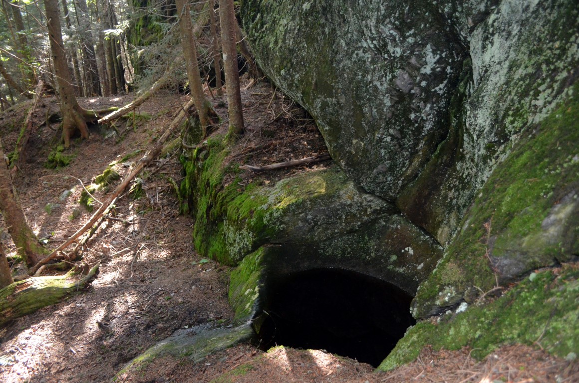
Then there are hidden treasures that require a little more searching to find. One is a glacial pothole on Burnt Rock Mountain located at the base of a small cliff. It’s only about seventy-five feet off the Long Trail, but no trail sign will lead you there. Only the lure of adventure and love of nature will help you find this unique geological feature.
Of course, you could start your hike to Burnt Rock Mountain from Massachusetts or Canada, but the easiest way is to follow the moderate blue-blazed Hedgehog Brook Trail past streams and ladders about two miles to the Long Trail. Then the Long Trail heads north toward the summit. The spur trail to the pothole leaves the Long Trail on the way to the summit, at a tiny rock cairn that may be knocked over and appear a random pile of rocks. If you pass a high mossy ledge to your right, you have gone too far! After you find the spur trail you only have a few steps to reach the most unusual pothole.
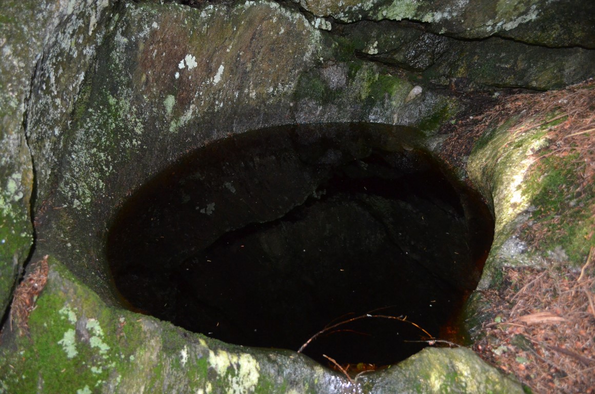
At an elevation of 2,820 feet, it is one of the highest known glacial potholes in New England. Most potholes were formed by waves or stream currents spinning rocks in a vortex. Because of its location at high elevation with no other evidence of a stream nearby, geologists conclude a subglacial stream formed this one. As water flowed beneath the glacier, a stream mixed with sand and debris plunged over the cliff, continuously swirling and eroding the rock into the pothole we see today. At one point, it may have been up to fifteen feet deep, but over time the rock around the pothole eroded and now it’s about three feet wide and thirty inches deep. Today the pothole is filled with water that glimmers off the nearby rock.
Stunning views and interesting hiking on exposed rock make an outing to Burnt Rock Mountain complete in itself, but the glacial pothole is an uncommon feature the hike offers. This unique piece of Vermont’s geological history, older than any trail, shelter or stone wall, is direct evidence of how the mountains we love and enjoy were formed.


Leave a Reply