

We asked and you answered! Our Long Trail hiking community on Instagram and Facebook replied to the question: What stick season hikes do you recommend? What do you like most about hiking this time of year?
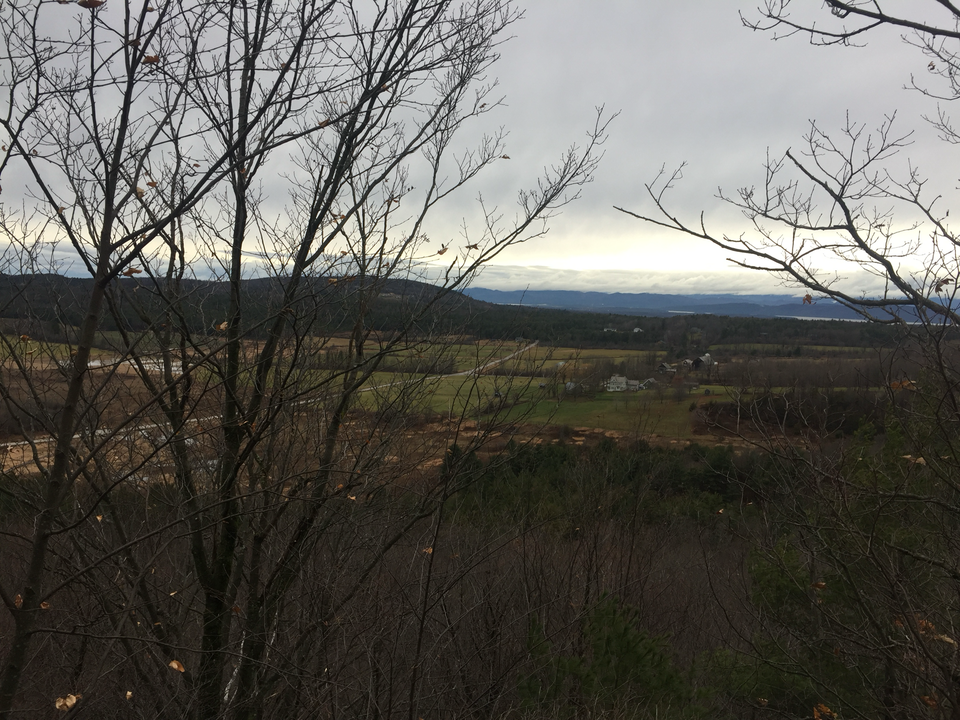
Overall, those who shared agreed that the peacefulness of quieter trails, clearer views of the surrounding landscape through the trees, and the signs of the changing seasons make Stick Season a very special time to enjoy the trails.
Explore these recommended stick season hikes, from hikers like you:
- White Rocks National Recreation Area – Wallingford
- Mount Abraham from Lincoln Gap – Lincoln
- Raven Ridge Natural Area – Monkton
- Snake Mountain and Silver Lake – Addison County
- Mount Hunger – Waterbury
Reminder: While the conditions in town, in the valleys, and at trailheads may be more mild and fall-like, during stick season you may also encounter winter conditions at higher elevations. Be prepared for a variety of weather and trail conditions while hiking during the shoulder season and be prepared with extra layers, a headlamp, and traction footwear if needed.
White Rocks National Recreation Area – Wallingford
“I hiked from White Rocks to Clarendon Gorge last year and loved the silence and the animals I saw. The clouds and the trees were also beautiful” – Alessandra Fabela
For a short and geologically fascinating hike, explore the Ice Beds Trail, from which hikers can view the White Rocks Cliffs, a geological feature of Cheshire quartzite exposed over 12,000 years ago in the last ice age. This hike is 1.4 mi roundtrip, with approximately 300 ft elevation gain. Following the blue-blazed trail from where it begins at the White Rocks Picnic Area, the trail leads up and over a knoll opposite the cliffs, providing great views of the rock features, before descending to the “ice beds” the trail is name for at the bottom of a rock slide. View this hike on Trail Finder
For a more challenging hike option in the area, explore White Rocks via the Keewaydin Trail and the Long Trail/Appalachian Trail. Starting from the White Rocks picnic area, follow the Keewaydin Trail for roughly half a mile until it meets the LT/AT and follow the trail south, climbing steeply for a little over one mile until reaching the White Rocks Cliff spur trail. The 0.2. mile spur trail leads hikers to a scenic overlook at the edge of White Rocks Cliff. Out-and-back, the hike totals 3.4 miles with several hundred feet of elevation change. View this hike on Trail Finder.
Mount Abraham – Lincoln
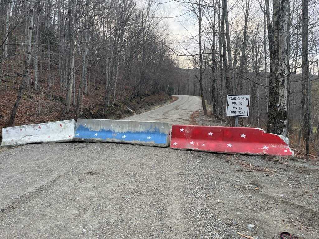
“Favorite stick season hike – Mount Abe! With Lincoln Gap Road closed, it’s such an interesting way to start the hike by walking up the mile of empty road. Plus, there is the tiny Lincoln Gap View Trail before you reach the top and the LT, which is super cool! And I had never checked it out in summer with all the cars on the road.” – Wes Dunn
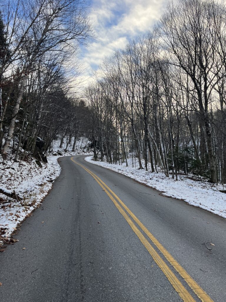
Starting from the designated parking area at the base of Lincoln Gap Road, hikers begin a mile-long road walk from the road closure to the top of Lincoln Gap and trailheads for the Long Trail heading north and south. About halfway up the road, a sign points hikers toward the short trail to the Lincoln Gap West Vista on the north side of the road. Hike 1.7 miles on the LT north from Lincoln Gap, gradually climbing until the junction of the LT and the Battell Trail. Continue on the LT for 0.8 miles, climbing steeply to the alpine summit.
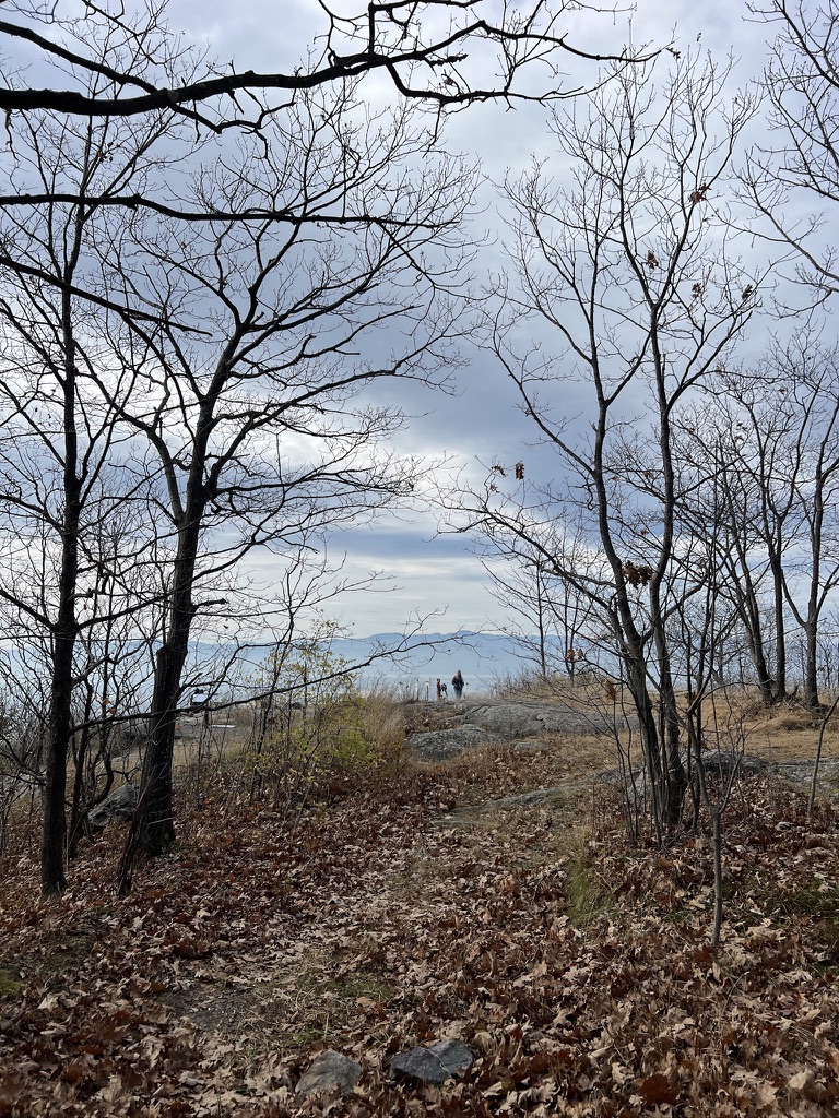
Raven Ridge Natural Area – Monkton
“I love that you can see more of the view without the leaves!” – Margaret Moody
Raven Ridge Natural Area, conserved and managed by the Nature Conservancy, hosts a 2.2-mile network of family-friendly trails, including an ADA-accessible boardwalk and gravel path through wetland habitat. From the accessible trail, a hiking path splits off and leads up and along the ridge with views of the Champlain Valley.
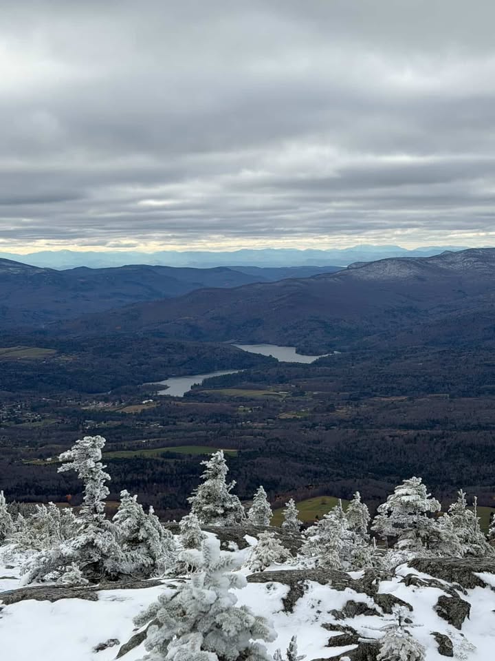
Snake Mountain and Silver Lake – Addison County
“When I lived in Middlebury, Snake Mountain and Silver Lake were in the regular rotation. The view from Snake Mountain is gorgeous, especially at sunset.
The forest road up to Silver Lake is so accessible, and a dip in the lake in the summer is the best. I love swishing through the leaves during stick season and how the view opens up through the woods as the foliage falls!”
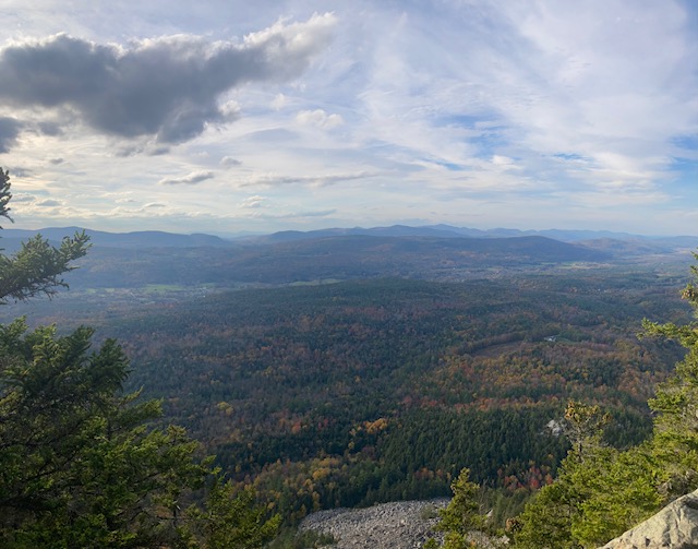
Snake Mountain hosts a network of several miles of hiking trails across Willmarth Woods (managed by the Nature Conservancy) and Snake Mountain Wildlife Management Area (managed by the Vermont Fish and Wildlife Department). The popular Arthur Gibbs trail to the 1,287 ft. summit begins in Willmarth woods and climbs mildly over the course of 1.8 miles to an overlook vista of the surrounding farmland and across Lake Champlain to the Adirondacks. View this hike on TrailFinder.
Moosalamoo Recreation Area, near Salisbury, contains nearly 20 miles of trails, including the 1.3-mile access trail to Silver Lake and Falls of Lana and 2.5 mile Silver Lake Loop (Rocky Point Interpretive Trail). Several other trails traverse the surrounding ridges and hollows. View this hike on TrailFinder.
Mount Hunger – Waterbury
“One of my favorites for stick season is Mount Hunger! Even if not summiting, fewer leaves make for some sneaky views of Mansfield and the spine of the Greens through the trees.” – Amy Ziobron
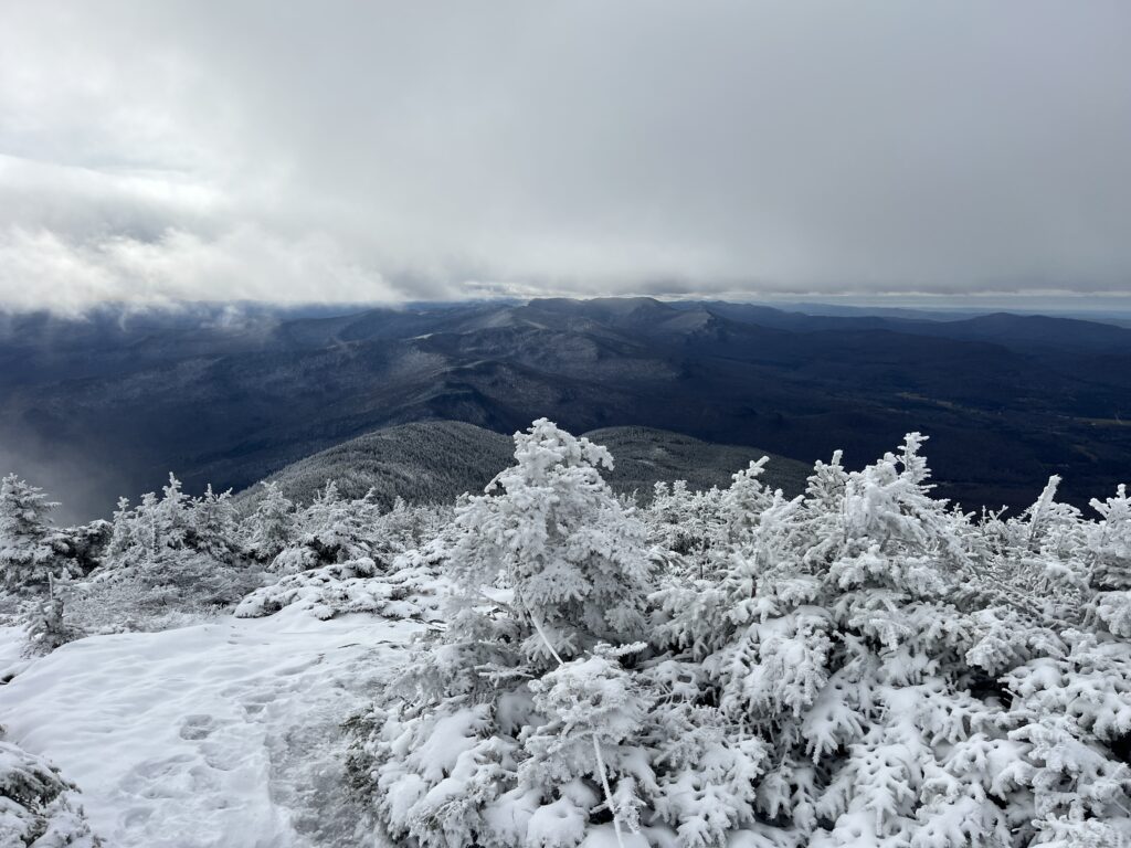
Mount Hunger, one of the most popular peaks in the Worcester Range, can be hiked via the Waterbury Trail or the Hayward Trail (formerly Middlesex Trail). The 3.6-mile round-trip hike on the Waterbury Trail climbs steadily to the rocky, exposed summit for panoramic views of the Green Mountains to the west, other peaks in the Worcester Range to the north and south, and White Mountains to the east. These and other trails within C.C. Putnam State Forest are managed by the Vermont Department of Forests, Parks, and Recreation.


Leave a Reply