 On Sunday, July 9, Green Mountain Club staff members and hikers started to understand the severity of the weather forecast. It had been a wet couple of weeks, but the consensus was that it was nothing out of the ordinary. However, by midday, pockets of torrential downpour were crossing the state, and the National Weather Service issued its first ever “High Risk of Excessive Rainfall” alert in Vermont. The Monday forecast was two to five inches of rain, with seven inches or more in unpredictable areas along the spine of the Green Mountains. We were paying attention now.
You made it possible for GMC to spring into action when we realized this would be more than just another rainy day. There are no relief funds for our type of emergency response, so the club relies on its core base of support when we must shift from funded projects to unfunded emergency response.
We pulled all field staff from the backcountry for their safety, and alerted hikers via social media and our website. The trail community really came together to help each other hike out, find rides, bypass closed roads, and find safe places to wait out the storm.
Infrastructure Assessment and Response
 By Wednesday, July 12, river levels had peaked, and our staff mobilized for the first phase of the assessment plan devised by Director of Field Programs Keegan Tierney:
1. Primary Rapid Infrastructure Assessment
2. Secondary Assessment: high-use LT and AT segments, side trails, and all overnight sites
3. Volunteer-Powered System-Wide Trail Sweep and initial recovery
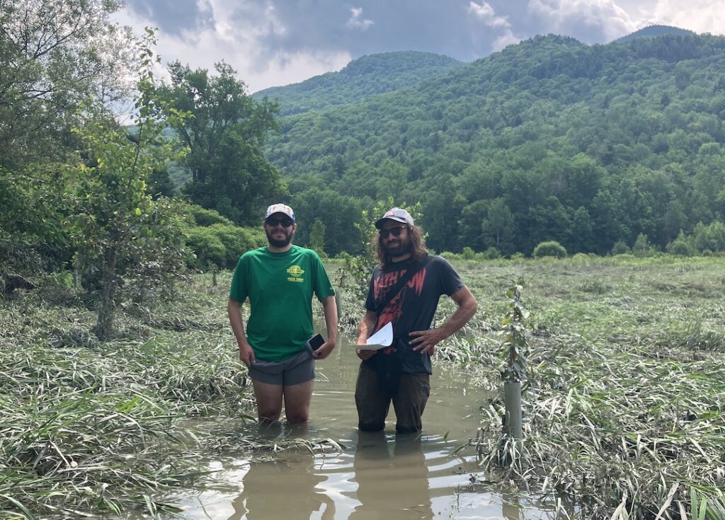
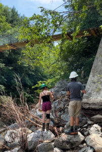
Working in threes for safety, field and office staff members fanned out to document damage. The primary focus the first day was road and trailhead access, and major structures like bridges and shelters. Some pieces of trail, like those in Winooski Valley farm fields and the Lamoille River high water channel crossing, were still under water. We found scouring and erosion at bridges, but no complete washouts.
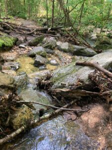
Using our new GPS-enabled mapping system to report, staff members surveyed trails for landslides, blowdowns, flooded sections, and damaged structures. The initial evaluation was favorable: no major infrastructure lost, no washouts threatening hikers or trail continuity. Some field staff members began returning to regular projects and ranges by the end of the week. But the flood remained the top priority, as caretakers monitored their ranges for minor and moderate damage. One trail crew and the special projects crew pivoted to assist community flood relief projects in Waterbury, Middlesex and Bolton.
After staff’s initial assessments we had still evaluated only about 100 miles of the 500-mile system. Only as of late summer, thanks to the corps of volunteer trail adopters, are we closing in on a statewide inventory of trail damage.
Heavy rain and flash flood warnings through the rest of July were an added challenge. Saturated soils and high water raised the risk of every storm, and complicated trail assessment.
Climate Change and the Long Trail
 The floods brought climate change front and center at the club, although the way the climate is changing and the resulting natural and human resource impacts were very much on our minds for years.
Research at the Hubbard Brook Experimental Forest in New Hampshire indicates that northern New England is getting warmer and wetter. For the Long Trail this means a longer hiking season, less snow and more ice in winter, and more frequent and stronger storms. Oh, and mud season is now no longer just a season, but can occur anytime – fun.
Managing the trail for climate change impacts
Some of our trails are more than 100 years old. The management strategy for most has been and still is to conduct annual maintenance and deploy professional crews periodically to repair the most damaged portions. This strategy worked well for more than a century, but with more intense and frequent storms, we must rethink construction and maintenance.
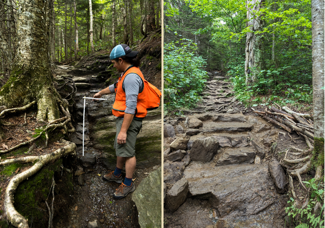
Two current situations are instructive: the Burrows Trail on Camel’s Hump and the Sterling Pond Trail in Mount Mansfield State Forest. Both are enormously popular, steep trails hiked for many decades, and they suffer from chronic erosion. The way they differ is that the GMC and our partners are rebuilding the Burrows Trail from top to bottom, while the Sterling Pond Trail is receiving the status quo model of few weeks of crew work annually for the most urgent needs.
Rebuilding the Burrows Trail is a massive and expensive undertaking. It will take three years, dedicated staff, multiple crews and $750,000. This project alone is at least 25 percent of the club’s annual trail budget.
But the investment is already paying off: trail structures installed in 2022 on the Burrows Trail held up in the July storms. Stone structures did what they were designed to do: moved massive amounts of water off the trail, and kept it off to protect the hiking surface.
“Burrows, while somewhat muddy in places, is in excellent condition, no doubt because of the impressive work that continues.” – Joe Iadanza, hiked July 23, reported on Facebook.
Keegan Tierney monitors erosion on the Sterling Pond Trail on a post-flood assessmentBy contrast, the Sterling Pond Trail was a wet, muddy mess. Previously repaired stretches suffered damage as water overwhelmed drainage structures above them, and as hikers avoided muddy or flooded areas, widening the treadway.
Perhaps rainfall was worse on the Sterling Pond Trail than the Burrows Trail, but even allowing for that possibility, it is striking how well the Burrows Trail held up and how poorly the Sterling Pond Trail fared.

The Burrows rebuild is showing the effectiveness of large investments in our most vulnerable and popular trails, and we hope to do similar work elsewhere.
The money and staff capacity required can’t be ignored, but in the long run this strategy could cost less, and provide better hiking as well.
Looking Forward
July’s flooding created about a quarter of a million dollars’ worth of minor repair projects for future field seasons. But it also reminded us our management and maintenance of trails must evolve.
As the climate changes, Vermont may not always see major infrastructure damage, especially as we build with these events in mind. Often we will see minor to moderate erosion, washouts, blowdowns, and other damage scattered along our trails.
We need a comprehensive evaluation of the Long Trail System for climate resiliency, examining drainage structures, routes in flood-prone areas, and old legacy trails that go straight up and down slopes and become raging streams in storms. Many trails will need a lot of money and skilled trail crew time to match the quality of the upper half of the Burrows Trail.
Beginning with the most traveled and vulnerable trails, we can steadily build and improve trails to survive more powerful storms. Investments may include trail hardening measures like stone steps; relocating extra muddy or erosion-prone segments; and training volunteers to spot problems early and to understand how a trail’s environment and use affect it.
Finally, we will consider establishing a climate change recovery and response fund. This will enable us to quickly deploy crews and material to fix minor and moderate storm damage without shortchanging our normally scheduled and funded field work.
How You Can Help
Your membership contributions and donations make it possible for the Green Mountain Club’s expert trail designers and builders to test new methods for resistance to extreme weather, and to strategically plan investments for resilience of the 500-mile Long Trail System. Thank you for your continued support and for being part of the solution for managing trails for climate change.


Leave a Reply