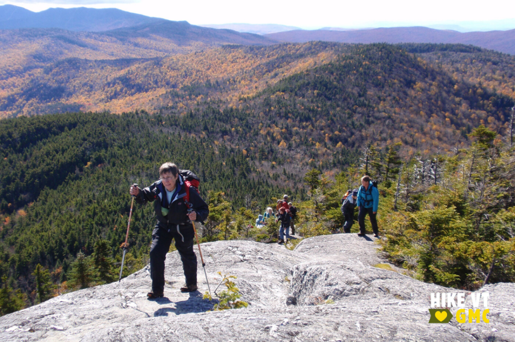
Let’s HikeVT! This week, we’re highlighting your favorite foliage hikes around the state. These four leaf-peeping destinations were elected by people’s choice, and vary in accessibility and location. Check out our fall hiking safety tips, grab your camera to share your photos online (#HikeVT), and have fun hiking out there!
- Burnt Rock, Fayston
- Lincoln Gap Rd to the Long Trail South, Lincoln
- Skylight Pond Trail, Ripton
- Holden Trail, Westminster
Burnt Rock via Hedgehog Brook Trail, Fayston— Difficult
» 5.2 mi round trip, approx. 2,010 ft elevation gain
Suggested by Ray Merrill (@ray.mer.94): The Hedgehog Brook Trail to Burnt Rock Mountain in Fayston is “stunning.”
This trail is located entirely on private land. Hikers are allowed to use the trail thanks to the generosity of the landowners, so please stay on the trail and do not block the gate at the trailhead in order to keep the trail open for future use. The trail descends from the parking lot to cross Hedgehog Brook over stepping-stones. The trail then climbs the slope and contours north to a woods road. Turn left and follow the wooded road uphill. Climb west steadily to the ridge where you will reach the intersection with the Long Trail. Turn right to follow the Long Trail north for 0.6 mi to the open summit ledges and stunning views from Burnt Rock.
Driving Directions: The North Fayston Road leads west from Vt. 100, 4.5 mi. north of Vt. 17 in Waitsfield and 8.0 mi. south of U.S. 2 in Waterbury. Follow the North Fayston Road; at 2.5 mi. this road turns to dirt; at 4.0 mi. stay straight at a four-way offset intersection, continuing on Big Basin Road to the trailhead (5.0 mi.) at a heavy metal gate, near a parking lot. Map it.
Lincoln Gap Road to the Long Trail South, Warren or Lincoln — Moderate to Difficult
» 4 – 22 mi round trip, approx. 1,300 – 3200 ft elevation gain
For all you trail runners out there, Lincoln Gap to Emily Proctor Shelter was suggested by Pete Saile (@petersaile) as a “nice leg stretcher.”
With Lincoln Gap Road closed for the winter, you can still run/hike up the extra mile on the road to access the Long Trail. The 22+ mile roundtrip to Emily Proctor may be too long for most people, but there are other destinations along this stretch of the Long Trail to make the trip worthwhile. You can reach Sunset Ledge in 4-miles round trip, or continue onto Mount Grant for a 9.8-mile round trip adventure. Both destinations have wonderful views.
Driving Directions: From Route 100 in Warren, follow Lincoln Gap Road until you see closure signs. From Lincoln, follow East River Road for 1.9 miles then take a left onto Lincoln Gap Road. *Please note there is limited parking from either side of Lincoln Gap Road. Be diligent not to block any road ways or plow turn arounds. Car pool if possible. Map it.
Skylight Pond Trail, Ripton— Moderate
» 5.2 mi round trip, approx. 1,460 ft elevation gain
Suggested by Marshall Miley (@Mark0yolo): Follow the “Skylight Pond Trail to a blue blaze west facing overlook and the gorgeous 44 step rock staircase!” Continue from there until you reach the Long Trail. Go straight onto the spur trail down to Skyline Lodge and Skylight Pond.
Driving Directions: Follow VT-125 2.9 miles west of Middlebury Gap. Take USFS-59/Steam Mill Road north for 3.6 miles to the trailhead for Skylight Pond Trail.
*Please note that parts of USFS 59 and 54 are closed during winter, so once snow and ice fall use the following directions to the winter parking lot: From the center of Ripton, follow U.S. Forest Service Road 59, also known as the Natural Turnpike, for approximately 3.5 mi. Bear left at a junction with USFS Road 54 and follow to a usually well-maintained and spacious parking lot on the right. Beyond this point, both USFS roads are closed from December 15 until the surface firms after the spring thaw. Map it.
Holden Trail, Westminster— Easy to Moderate
» 3.0 mi round trip, approx. 457 ft elevation gain
Suggested by Mickey Nowak (@southernvermonthiker): Holden Trail to the Pinnacle, “one of the best views in Southern Vermont” is managed by the Windmill Hill Pinnacle Association. It is part of a “Walk through Time Interpretive Trail” that brings you by historic cellar holes and stone walls to the Pinnacle Shelter and viewpoint.
Driving Directions: From Route 121 in Saxtons River, follow Westminster West Road south for 5.8 mi to then bear right onto West Road for almost a mile before turning right onto Windmill Hill Road North. The trailhead is a mile on your right.
From Putney Village, follow Westminster Road becoming Westminster West Road for 6.9 miles to West Road. Follow the above direction from here. Map it.
Questions? Our visitor center staff is here to assist you. Call (802) 244-7037 or email [email protected].


