

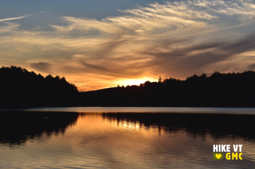
Let’s HikeVT! This week, we’re recommending overnight hikes for beginner backpacking. We’ve limited them to one-night outings, but they’re great overnight options for even the most experienced outdoors people. You can also extend your stay on the nearby trail networks. Check out our Backpacking 101 Video, try a recommended hike, and share your photos online: #HikeVT!
- Jay Camp, Westfield
- Taylor Lodge, Stowe
- Skyline Lodge, Ripton
- Little Rock Pond Shelter & Tenting Area, Mount Molly
- Stratton Pond Shelter & Tenting Area, Stratton
Jay Camp, Westfield
» 0.6 mi round trip, approx. 240 ft elevation gain
Jay Camp is only 0.3 mile from Route 242, allowing for a quick and easy hike in if it is your first-time hiking with a heavy backpack on. The four-sided shelter has space for 10 hikers, as well as, room around the shelter for a few tents. If you want more of a challenge, you can continue north on the Long Trail for another 1.4 miles to the open summit of Jay Peak for 1,680’ of elevation gain.
Driving Directions: From Enosburg, head east on VT-105 then turn right on V-118. After 7.1 miles, turn left on VT-242. Parking is in a pull-off on the right side of the road after 6.4 miles. The trail to Jay Peak is across the road from the parking area. Map it.
Taylor Lodge via Lake Mansfield Trail, Stowe
» 4.6 mi round trip, approx. 750 ft elevation gain
The Lake Mansfield Trail gradually rises near the edge of Lake Mansfield before turning away from the lake to ascend at a slightly steeper grade. The trail brings you through a gorge, past the piped water source, to a beaver pond and views of the north wall of Nebraska Notch. Continue until you reach Taylor Lodge, a four-sided shelter with room for 15. There is also abundant space for tents if the shelter is full.
Driving Directions:
From Route 100 north in Stowe, turn left onto Moscow Road. Follow the paved road, which turns into the Nebraska Valley Road and becomes gravel-surfaced, 6.7 miles to the gate of the Lake Mansfield Trout Club. For overnight parking, turn right on Old County Road just before the closed Trout Club gate. There is a large parking lot on the left a few hundred yards down the road. For day use, you may drive through the open gate to the hiking season day-use parking lot that is to the north of the main building of the Trout Club.
*The trailhead from the summer parking area begins on the private land of the Lake Mansfield Trout Club. Please be considerate of club guests, stay on the trail, and respect the land and all buildings while in this area. Map it.
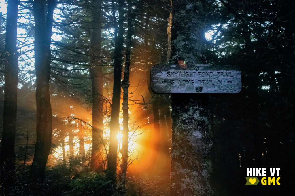
Skyline Lodge, Ripton
» 5.2 mi round trip, approx. 1,460 ft elevation gain
Follow the Skylight Pond Trail as it moderately climbs and switchbacks up to Skyline Lodge. This four-sided shelter sleeps 14 and is found on the shores of the scenic Skylight Pond. There is no camping in the immediate vicinity of the shelter, but if it is full, you can find tent space 500’ south of the shelter spur on the Long Trail.
Driving Directions: From VT-125, turn onto Steam Mill Rd. Follow this gravel road from about 5.6 miles to trailhead parking at Steam Mill Clearing. Map it.
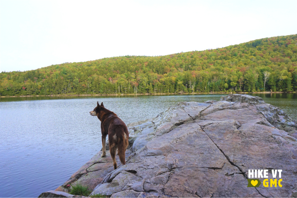
Little Rock Pond Shelter and Tenting Area, Mount Holly
» 6.7 mi round trip, approx. 1,009 ft elevation gain
There are two options for reaching Little Rock Pond. For a longer trip, follow the Green Mountain Trail 3.2 miles to the pond. For an easier and shorter option, follow the Long Trail North 2.2 miles to the pond. Hikers have the choice of camping at the tent site on the north end of the pond, or staying at the three-sided shelter on the south end. Although not fully enclosed, it is a lovely shelter that fits 14.
Due to the fragile shoreline and high use, there is a caretaker to help educate and guide hikers to appropriate campsites. There is bear box available for proper food storage.
Driving Directions: From the intersection of US-7 and Brooklyn Road in Danby, take Brooklyn Road east (USFS Road 10) for 3.2 miles to a paved parking lot on the right, 0.6 miles past the Big Branch Picnic Area. Start your hike near the sign board directly across the road from the parking lot. Map it.
Stratton Pond Shelter and Tenting Area, Stratton
» 11.5 mi round trip, approx. 1,645 ft elevation gain
Stratton Pond can be easily accessed via the Stratton Pond Trail. For a longer, more difficult, and more scenic route follow the Long Trail over the summit of Stratton Mountain. At the summit, you will find a fire tower providing 360-degree views of the surrounding area. Continue on the Long Trail north to Stratton Pond where hikers have a choice to stay at the shelter, which fits 20, or follow the Lye Brook Trail to the west side of the pond to the Stratton View Campsite.
Hikers can make a loop by following the Stratton Pond Trail back to the Stratton-Arlington Rd. A short road walk will bring you back to your car.
Due to the fragile shoreline and high use, there is a caretaker to help educate and guide hikers to appropriate campsites. There is bear box available for proper food storage.
Driving Directions:
From Route 7 in Arlington: Take the Arlington exit and turn west on Rt 313 at the end of the exit ramp. Take the first right onto South Rd. and follow to the end. Turn right onto Kansas Rd., and follow over Rt 7 and over a one-lane bridge. After the bridge, turn right and travel east on the Stratton-Arlington Road (aka: Kelley Stand Road) past the parking for the Stratton Pond trail until you see signs for the Long Trail parking area on the north (left) side of the road.
From Route 100 in West Wardsboro: Drive west for about 7 miles on the Stratton-Arlington Road (aka: Kelley Stand Road) until you see signs for the Long Trail trailhead parking. The parking area will be on the north (right) side of the road. Map it.
Questions? Our visitor center staff is here to assist you. Call (802) 244-7037 or email [email protected].


