

Let’s HikeVT! This week we’re featuring low-elevation hikes that lead to scenic waterways, like lakes and ponds. Know before you go: proper footwear, safety, and activities for mud season.
- Brighton State Park, Brighton
- Island Line Trail, Burlington to South Hero
- Kettle Pond State Park, Groton
- Emerald Lake State Park, East Dorset
- Little Pond Trail, Woodford
Brighton State Park, Brighton
» 1.5 mi loop, approx. 40 ft elevation gain
Make a loop by following Main Trail and Shore Trail. Shore Trail has several viewpoints of the Lake along the way.
Directions: From the town of Island Pond, turn off of VT-114 and onto VT-105 (East Brighton Road). Continue on VT-105 for 1.6 miles, turn right onto Lakeshore Drive, then turn left onto State Park Road, which is the entrance to Brighton State Park. When the state park is open, please stop at the contact station to pay day use and camping fees. To access the parking area, turn right when the park road comes to a T, then turn left on the campground loop and then left on the spur road to the parking area. Map it.
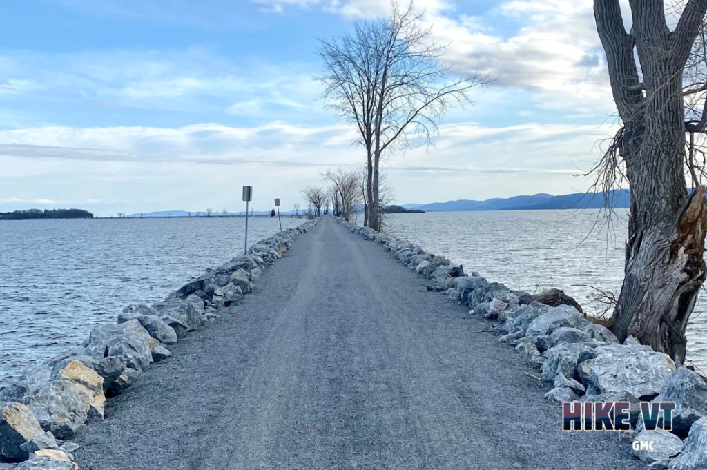
Island Line Trail, Burlington to South Hero
» 14 miles one way, approx. 50 ft elevation gain
This trail follows Lake Champlain’s shoreline from Burlington through Colchester and across the Colchester Causeway, which goes through the middle of the lake to South Hero. Whatever distance you choose to hike, you will be sure to encounter beautiful scenery along the lake.
Directions: There are many access points for the Island Line Trail. The trail starts at Oakledge Park in Burlington. To get there from Route 7 South, turn right onto Flynn Ave. Parking is at the end of the road.
Map it.
Kettle Pond State Park, Groton
» 3.1 miles, approx. 38 ft elevation gain
With more than 26,000 acres, Groton State Forest is the second largest contiguous land holding in the state of Vermont. Although there are many lakes and ponds to choose within the forest, the Kettle Pond Loop is a nice mud season option that circumnavigates the remote Kettle Pond. There is also a short ADA accessible path to the boat launch.
Directions: From Route 89: Take exit 8. Follow Route 2 East for about 20 miles to Route 232 South in Marshfield. The trailhead is on Route 232, 6.5 miles south of US-2 on your right. Map it.
Emerald Lake State Park, East Dorset
» 2.5 miles round trip, approx. 22 ft elevation gain
The Lake Trail follows along the shore of Emerald Lake with nice views along the way to its southern end.
Directions: From Rutland, drive south on US-7 for 22 miles. Turn right onto Sweeny Lane, then turn left immediately onto Emerald Lake Lane. The park entrance is another 0.2 miles down the road. Map it.
Little Pond Trail, Woodford
» 5 mi round trip, approx. 200 ft elevation gain
Starting from a small parking lot on Rt 9, the trail follows a dirt road past a few houses to a power line that provides nice views. From there, it continues as a flat woods road walk to Little Pond.
Directions:
From Bennington: Head east on VT-9 E. Pass through the village of Woodford. 1.8 mi after passing the Woodford Mountain General Store, the Little Pond parking lot will be on your left. The dirt lot has a wooden trail sign in it.
From Wilmington: Head west on VT-9 W. 1.4 mi after passing the entrance to Woodford State Park, the Little Pond Parking lot will be on your right. The dirt lot has a wooden trail sign in it.
Via Public Transit: The Green Mountain Community Network’s Emerald Line connects Bennington and Wilmington, passing the Little Pond Trailhead. For more information, including current operating schedule, call 802-447-0477 and visit www.greenmtncn.org.
Back to HikeVT.
Questions? Our visitor center staff is here to assist you. Call (802) 244-7037 or email [email protected].


