

Let’s HikeVT! This week we’re featuring difficult hikes that lead you up 4,000′ mountains. These hikes are longer and steeper than past recommendations and snake above tree line to open, exposed summits. Please take caution and be prepared with the proper gear before undertaking these routes.
- Mount Mansfield via Sunset Ridge Trail, Underhill
- Camel’s Hump via Burrows Trail, Huntington
- Mount Abraham via Battell Trail, Lincoln
- Killington via Bucklin Trail, Mendon
Mount Mansfield via Sunset Ridge Trail, Underhill – Difficult
» 8.1 mi round trip, approx. 3,000 ft elevation gain
From the parking area, the route follows the unplowed State Park Road 0.75 mi. to the first gate. From the campground, follow the Eagle’s Cut Path to the intersection with the Sunset Ridge Trail. Follow the blue-blazed Sunset Ridge Trail as it steadily climbs to the open ridge. Since the blue blazes are often snow-covered along the ridge, the trail route is marked by rock cairns (piles of small rocks). At the junction with the Long Trail, turn left to follow the Long Trail north to the summit.
This can be a difficult trip due to the potential for extreme weather, ice and deep snow on the trail and the 3,000 ft. elevation gain. Depending on seasonal ice conditions, snowshoe crampons may not provide sufficient grip above tree line and it may be necessary to use full crampons. Caution: approximately one mile of this hike is above tree line, and high winds can cause reduced visibility or whiteout conditions, making route finding nearly impossible.
Driving Directions:
From Burlington/Interstate 89: Head south on I-89 S. Get off at Exit 11 for US-2 W (also x11 from I-89 N). Turn onto US-2 W, then quickly turn right onto VT-117 W. Take an immediate right on Gov. Peck Highway. When road ends, turn left on Browns Trace Rd. When road ends, turn right on VT-15 E. In .5 mi, turn right on River Rd. After passing Underhill Central School, turn right on Mountain Rd., which ends at Underhill State Park.
From Jeffersonville: From the rotary, head south on VT-108/VT-15 W. Turn left on VT-108/Church St. Pass the post office and turn right on Upper Pleasant Valley Rd. Merge onto Pleasant Valley Rd. In 5.6 mi, turn left onto Mountain Rd. If you see the school, you just missed it. Mountain Rd. ends at Underhill State Park.
Map it*
*Underhill State Park closes the second Monday in October. The park gate will be closed, so park in the plowed parking area and hike the road 1 mile to the start of the trail.
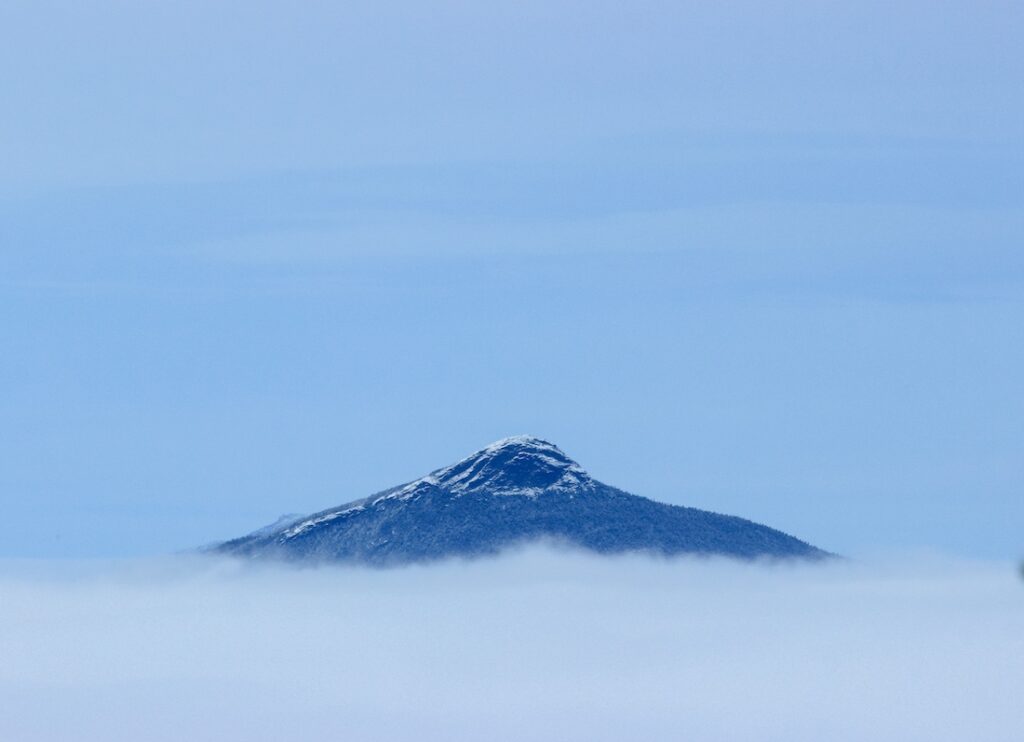
Camel’s Hump via Burrows Trail, Huntington – Difficult
» 4.8 mi round trip, approx. 2,461 ft elevation gain
The Burrows Trail offers the easiest access to the summit of Camel’s Hump and its spectacular view of the Champlain Valley, the Adirondacks, and the major peaks of the Green Mountains. Although the trail is not particularly steep, it does climb persistently to the Hut Clearing just below the summit, before following the Long Trail for the last stretch to the top. The hut clearing is a sheltered spot that is a great place to put on additional layers for the climb above tree line to the summit. The trail does gain considerable elevation from the parking lot to the summit, but since the trail is very popular, it is usually well packed down by both snowshoers and skiers.
Driving Directions:
From Richmond/I-89 Exit 11: Turn onto US-2 E. In the center of Richmond, turn right/south on Bridge St. Pass the round church and turn Right on Huntington Rd. After crossing Huntington River, bear right on Main Rd. Stay right on Main Rd. in village of Huntington. Continue for 2.5 mi and turn left on Camel’s Hump Rd. in Huntington Center.
From Bristol: Head east on VT-17 E. Turn left on Gore Rd. before road begins steep ascent to App Gap. After 6.2 mi, turn right on Camel’s Hump Rd. just after Huntington Town Office.
Lower Forest City/overflow lot is on right .8 mi after passing Hallock Rd. Please park perpendicular to the road in the dirt pull-off. Map it*
Upper Forest City/Burrows lot is at the end of Camel’s Hump Rd, .7 mi past lower lot. If upper lot is full, use lower lot instead of parking along the narrow road. Map it*
Mount Abraham via Battell Trail, Lincoln – Difficult
» 5.8 mi round trip, approx. 2,500 ft elevation gain
With Lincoln Gap closed in the winter, the Battell Trail is the best way to summit Mount Abraham. This blue-blazed trail is generally a moderate and pleasant hike. After about 2 miles, it intersects with the Long Trail. Turn left to follow the Long Trail north past the Battell Shelter. The trail steepens up for a short scramble before reaching the open, alpine summit.
Driving Directions:
From Main St. in Lincoln by the general store, turn north on Quaker St. At 0.7 mi, turn right onto U.S. Forest Service Rd. 350, also known as elder Hill Rd., where a sign at the intersection points to the Battell Trail. Continue on Elder Hill Rd. 1.9 mi. to a gradual left turn, past a farm on the right. The trailhead is 0.1 mi. from the turn, although this final stretch is not maintained in winter. There is limited parking at the left turn and hikers should pull off the road to avoid blocking driveways, other forest roads, or the snowmobile right-of-way.
Killington Peak via Bucklin Trail, Mendon – Difficult
» 7.4 mi round trip, approx. 2,450 ft elevation gain
The Bucklin Trail gradually follows an old road for about 2 miles before leaving the road and beginning a steadier climb to intersect with the Long Trail. Turn right to follow the Long Trail south for a short distance to Cooper Lodge. Cooper Lodge is the highest overnight structure on the Long Trail at 3,900’. After the lodge, take the spur trail on the left to reach the summit. The spur trail is only 0.2 mi to the summit, but is extremely steep and can be treacherous in icy conditions. The open, rocky summit affords fantastic 360 views.
Driving Directions:
From Sherburne Pass on U.S. 4 in Killington: Travel 4.3 miles west, turn left onto Wheelerville Road. Follow this twisting gravel road 4.0 miles to a right turn, which is Brewers Corners. There is ample plowed parking at the trailhead just west of the corner. Do not block the gate on the old Killington Carriage Road that leads south from Brewers Corners.
From Rutland: From South Main St. (U.S. 7 South), turn onto Killington Ave. at a traffic light 0.5 mile south of the junction with U.S. 4 east. Turn right at the end of Killington Ave. onto Notch Road. After a steep climb, the pavement ends and shortly Wheelerville Road forks left from Notch Road. From the fork, it is 3.1 miles northeasterly to Brewers Corners.
Maps:
Places to rent snowshoes:
- Umiak Outdoor Outfitters, Stowe
- Outdoor Gear Exchange, Burlington
- First Stop Board Barn, Killington
- The Mountain Goat, Manchester
- VT Libraries with Snowshoes through Rise VT
Questions? Our visitor center staff is here to assist you. Call (802) 244-7037 or email [email protected].


